
Unkle and Unkle descending the summit…
Bagged Baring Mountain on Friday. This sentinel of HWY 2 has been on my RADAR for some time to come. I had some multi-path GPS issues in my recordings: 3913 feet gain, 7.4 miles, 11 hrs C2C (more on this), Moving Time: 5:30, Total Time 11:37. After a 5:40 wake-up call, we hit the trailhead at 9 AM. Coffee and marionberry pie took their time to consume. The day looked perfect for climbing.
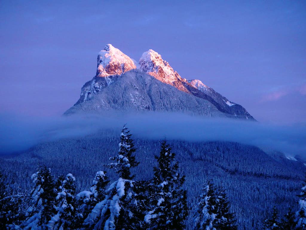
I’ve hiked and climbed a lot of steep stuff over the years, and have been on the search for some of the steepest, hardest hiking trails in WA. Yes, I know in this group it’s probably most of our boot paths up to some proper climbing, so I should just switch my focus, however, Baring Mountain consistently comes up in the top 5 hard trails and is the third steepest peak in Washinton. I now consider “trails” such as Mailbox Peak, the Kamikaze route up Teneriffe, and others as much more trail-like, and not really all that challenging. The bar has been raised – I personally like lots of scrambling.
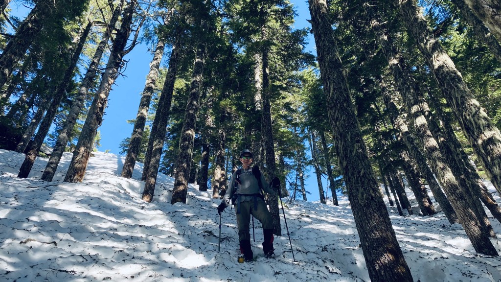
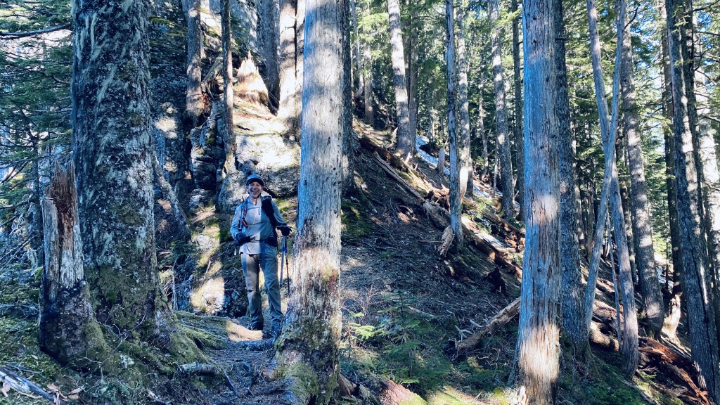
Overall the trail is as advertised – it’s a very rooty and dirt trodden goat path up to the ridge. Fortunately, someone flagged the trail with pink ribbon pretty well – I say this as there were two areas where we lost the trail and ribbons and wondered if somehow someone neglected to identify the path on the more interesting bits, just when we needed them, or perhaps we were off route. The exercise is left to the reader. The upper quarter of the route is covered in hard-packed snow. We opted to find more non-snow – dirt, rock, and blowdowns, and as a result, got off the path a bit too far to the right, and ended up retreating from a couple of questionable cliffy areas, until we went left, and followed the gully straight up the snow. If we had donned microspikes earlier, we would have stayed on the snow and probably made better time to the ridge – this remained a theme throughout the day. At the end of the day, descending from the ridge, we were able to find more of the missing flagging, making the initial third of the way a bit more manageable.
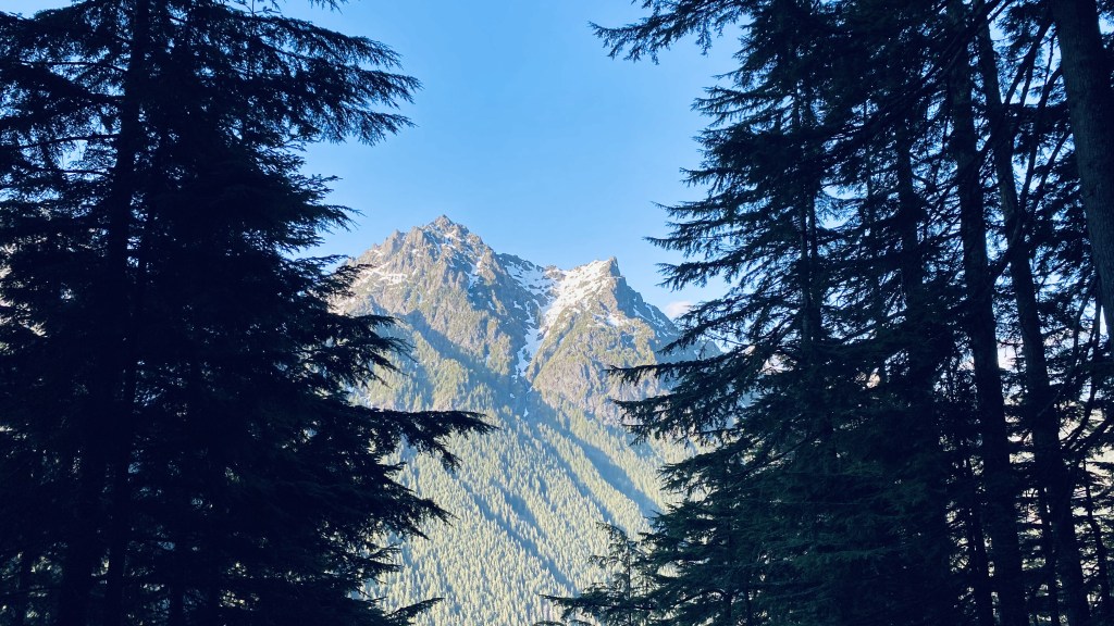
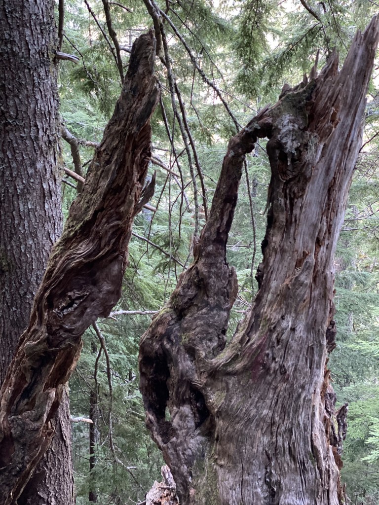
Many people complain about the difficulty, roughness, and downright crappy terrain up this path. I found parts to be quite beautiful. There are many interesting rock formations and amazing giant trees and roots growing around the rocks resembling a giant bonsai garden. Just be aware that as you ascend, there are a couple of spots about 2/3rd of the way up that have some significant exposure on the right side of the path. A fall would be most unfortunate. As we ascended, Tailgunner, Wing, and Merchant Peaks come into view (peaks to add to the ever-increasing list of things one must climb), revealing breathtaking mountain vistas – which were only better on the descent in the waning sunlight of the evening’s Alpenglow. My advice for this section is to don your microspikes when you hit the snow as it will make the uphill progress much faster. We also wore ours the entire descent from the ridge as the dirt is steep, loose, and overall it just helped us with our stability.


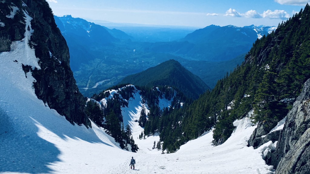
We made the ridge in just under two hours including our unplanned circuitous route-finding and cliff band navigation and began a quick traverse to the beginning of the basin. We figured we were making pretty good time for a couple of old guys and would have the summit in no time. The ridge is an absolutely gorgeous walk, with lots of mossy rocks, and amazing views to the left. As we approached the area where the path veers off the ridge as it eventually will cliff you out, we followed the flagging which appeared to follow the summer route. Much of the time we were able to follow some boot tracks, but somehow the snow was too hard for these to persist and we generally kept to the right and headed up. Note, it is best to keep left and try to hug the ridge as close as possible in our post-trip assessment – we descended this route as you can see from our GPX track which was a much better route – I wish we did this ascending. Although steep, it would have been much easier and would have saved us a bit of time as well. We ended up losing the flagging and traversed around for about two hours up steep forest slopes, trying to avoid a series of rocky outcrops and other steep terrains. We were in crampons here and I suggest putting these on sooner vs. later. I was not sure from the terrain if we were aiming for what ended up being the correct saddle to the left or if we needed to go right of the rocky ridge which ended up being the direct ridge to South Baring. We initially were going directly up the ridge leading to South Baring – in retrospect a navigation error. We eventually veered left and saw blue sky which I assumed was the path to the pass leading to the basin and the beginning of the next stage of the climb.


Upon cresting the pass, we found several current boot tracks and both peaks of Baring came into view. Finally, we saw our objective, and the route finding challenges came to a glorious end! In retrospect, we felt this last part of the climb up the steep forest to be the most difficult of the day, and another party we met on Baring concurred as well. It was steeper than even the dreaded snow wall. We made good time up the col, noting a lot of avalanche debris from trees and rocks. We reached the saddle or notch in quick order relative to the previous route segment and made for the snow wall. It was early afternoon and the sun had warmed the snow which was soft for the accent up the snow wall. There were visible steps up, however, these were not very structurally sound and we forced on kicking in some bomber steps – even so, my footing gave way a couple of times – fortunately, the run out here is safe with no exposure so I was not overly concerned. Upon reaching the top of the snow well, we met another party of two who has just summited. We exchanged some notes about the day and route and agreed that the steep forest section was the most challenging we both encountered for the day.


Unkle and I made the summit which was fairly easy and we enjoyed a few minutes of the views which are spectacular. I love how you can see down the Skykomish valley, out towards Puget Sound, the Olympics and even the Seattle skyline – much of the Alpine Lake Wilderness is visible as we enjoyed a different vantage of many of the peaks from the north. We descended quickly to the snow wall and hoped that the steps would be in decent condition and not too soft from the sun. I recall the other climbers commenting after pausing to chat with us, that “the wall would not climb itself”, so I took lead on the descent, careful to rekick in the steps as the snow was soft, and ensuing my axe was securely plunged with each step-down. We each took the wall down separately so if one of us fell, the other would not take out the other. After 10 minutes of down climbing, we reached the saddle and began a rapid plunge-step descent.


On the descent a large tree log cascaded down the hill above us, aiming for our path. Fortunately, it hit a large rock outcropping and came to a stop. This thing would have taken us out like a baseball bat. Please pay attention and practice good situational awareness in this area. The mountain was very kinetic the rest of the day. We heard three sizeable avalanches from South Baring and several large rapports of rockfall off Baring, startling us with their explosive percussion. One of the avalanches happened on our final push-up Baring, and given the echo, I initially thought it was directly above us. We would have been swept off the mountain and over the edge, however fortunately I realized it was on the other peak and was mindful given the increasing afternoon sun that we would be well served to summit and get off as quickly as possible. We quickened our pace to get off the col and out of the avalanche debris path, ascending to the pass and taking a lunch break.
As we began our final push to get to the ridge, we planned to take a more direct down. Fortunately, the climbers ahead of us shared our plans and we followed their tracks down to the ridge and made much better time down.


We took the ridge out enjoying the late afternoon views of the peaks to the West. As we reached the point of descent down the final steep path, we donned our microspikes and had more success following the flagging down, realizing our navigation mistakes from earlier in the day. About halfway down the path, I realized that I recognized almost none of the trail. I must have blocked out the memory of the ascent, but it seemed completely foreign. I know on many trips, descending at the end of a climb that I often realize just how long some of these trips and ascents are, as I am reminded on the way down, and often amazed and surprised at just how long or far up we came earlier in the day. This is a beautiful mountain to climb. I am so happy to have done it with a lot of snow cover as the gully in the summer does not look as appealing. South Baring has some appeal as an objective, and why not, we nearly inadvertently climbed it from the forest.

https://www.strava.com/activities/5298796612
https://www.alltrails.com/explore/recording/baring-mountain-a9d34fb
https://photos.app.goo.gl/PydqcvhYxMr3tRS67
I found a purple Nalgene bottle on the col – if this is yours, please let me know and I will happily return it to you.
cheers,#thehad