I don’t really like to repeat hikes unless I am short on time and it’s a getting out or staying in choice, or I need a short and close conditioner. Tiger Mountain in Issaquah fits both needs for me. The Cable Line route up Tigger West 3 (the lowest of the three prominent high points) gains 2000 feet of elevation in 1.5 miles. It’s a local testbed for training, conditioning, and many local hikers, runners, and climbers use it often.
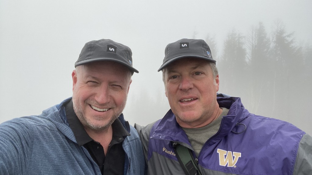
I was at a work function speaking with my colleague and fellow Senior Partner at Launch Consulting, Chad Holmes, and we got to talking and thought it would be fun to get out on a hike and get to know each other better on a trail. I feel like I should have known Chad much longer – we both went to the University of Washington from 1986-1990, have common friends in my Electrical Engineering Department, both started our careers with Accenture, so have a shared history across multiple dimensions, and are forging a new friendship with authentic beginnings. He had read my blog here and likes to hike as well, so we agreed on the Cable Line as it would fit our meeting schedule for the day and afford time for a proper meal afterward.

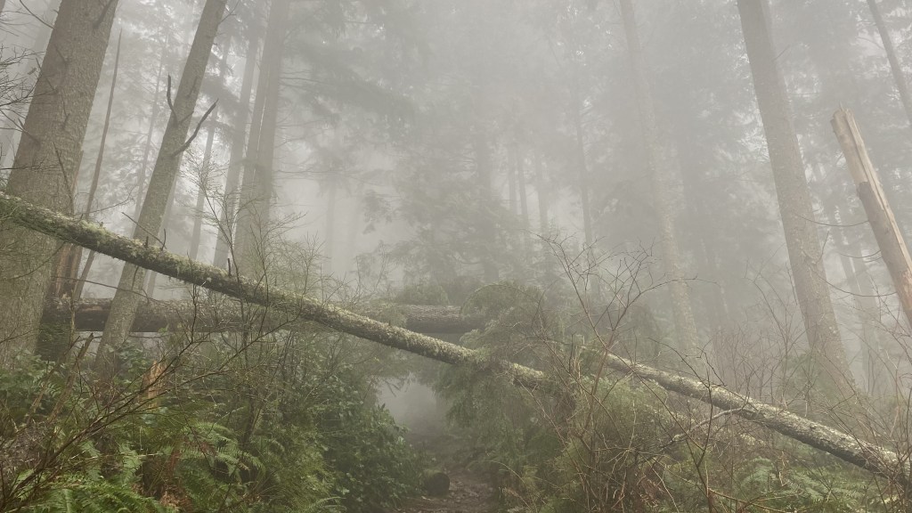
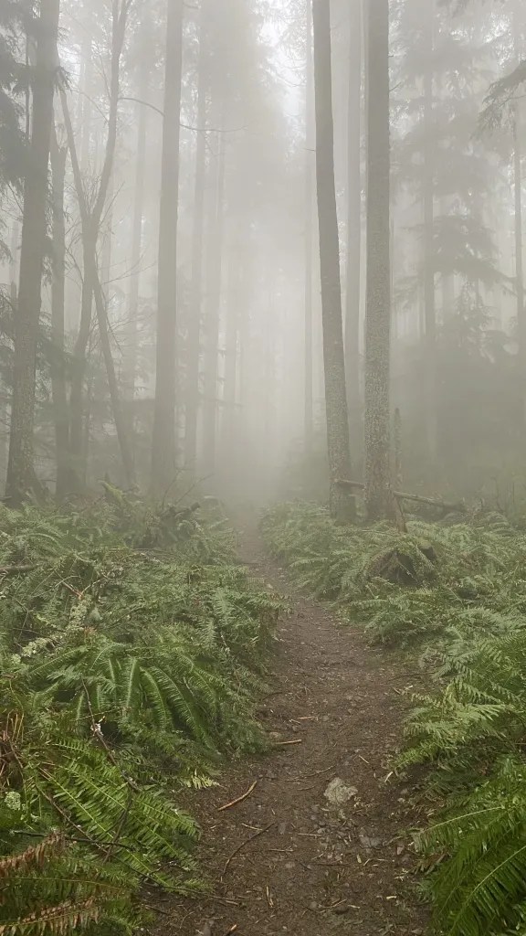
As we approached the trailhead, the mountain was shrouded in a sea of low-lying clouds, which would create very mystical atmospheric effects for our outing. As it turned out – I find I really love inclement weather – mostly clouds – rain, and snow are ok, wind sucks.

We started our ascent, crossed the electric utility power line right of way, and began our muddy ascent up the trail. The first bit is I think the worse as it’s the steepest and muddy and does not let up until about 0.6 miles in. I would say that we had some scintillating conversation on the way up, but apparently, I am out of shape, and I listened while Chad did all the talking. Our marketing depart was riffing on the concept of me taking executives on hikes and discussing our company Launch’s role as the Navigator of Digital Transformation – who better to lead Navigation than me? Well apparently, I need about 10 more Cable Line trips under my belt before I can carry a conversation – terrible. Chad may have to tag me in later.


After a lot of listening on my end, we blessedly reached the summit.
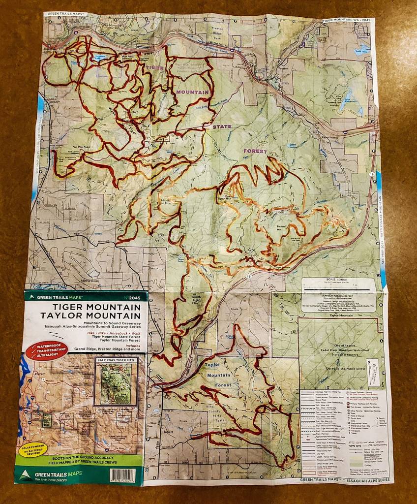
Sadly the summits of all Tiger Mountain Peaks were recently logged – they opened some views, but the raw and visceral devastation of this deforesting is sad in my opinion – fortunately, the clouds obfuscated the carnage. We refueled on a quick snack and opted to take a different route down the mountain. As I mentioned earlier, I am not a fan of repeat summits. Every time I climb a mountain I have previously summited, that’s one less new mountain I could climb in my future. Food for thought on how we choose to spend our time. However, in one of the FaceBook climbing groups of which I am a member, someone authored a post and shared a Green Trails map highlighting every single trail on Tiger Mountain they hiked. Now last year I hiked the Issaquah 24 – 24 peaks on Cougar, Squawk, and Tiger Mountains. Reviewing my trail tracks on Gaia GPS, it appears I have done about 50% of the trails – now I have a reason to continue to climb Tiger Mountain as it is literally crisscrossed with an absolute maze of trails.

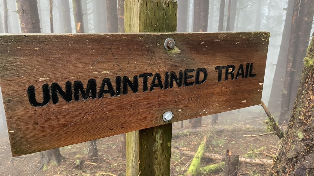
We descended an unmaintained trail called the Section Line that would connect to the Nook trail and eventually our starting point. I must say that this trail was not any less steep on the descent vs. the Cable Line route we took up.


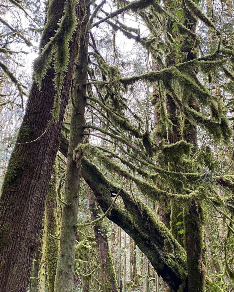
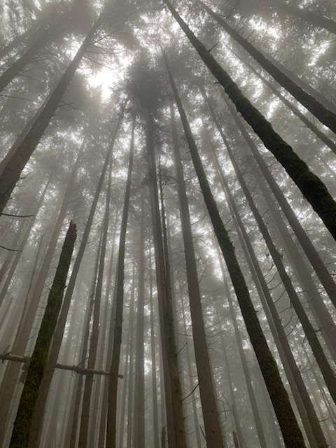
The route down the Section Line Trail was steep but fortunately not muddy. We passed through the misty forest, the trees like ghostly sentinels observing our presence – it was a bit eerie and chilling – thankfully I had Chad my stunt double for protection!
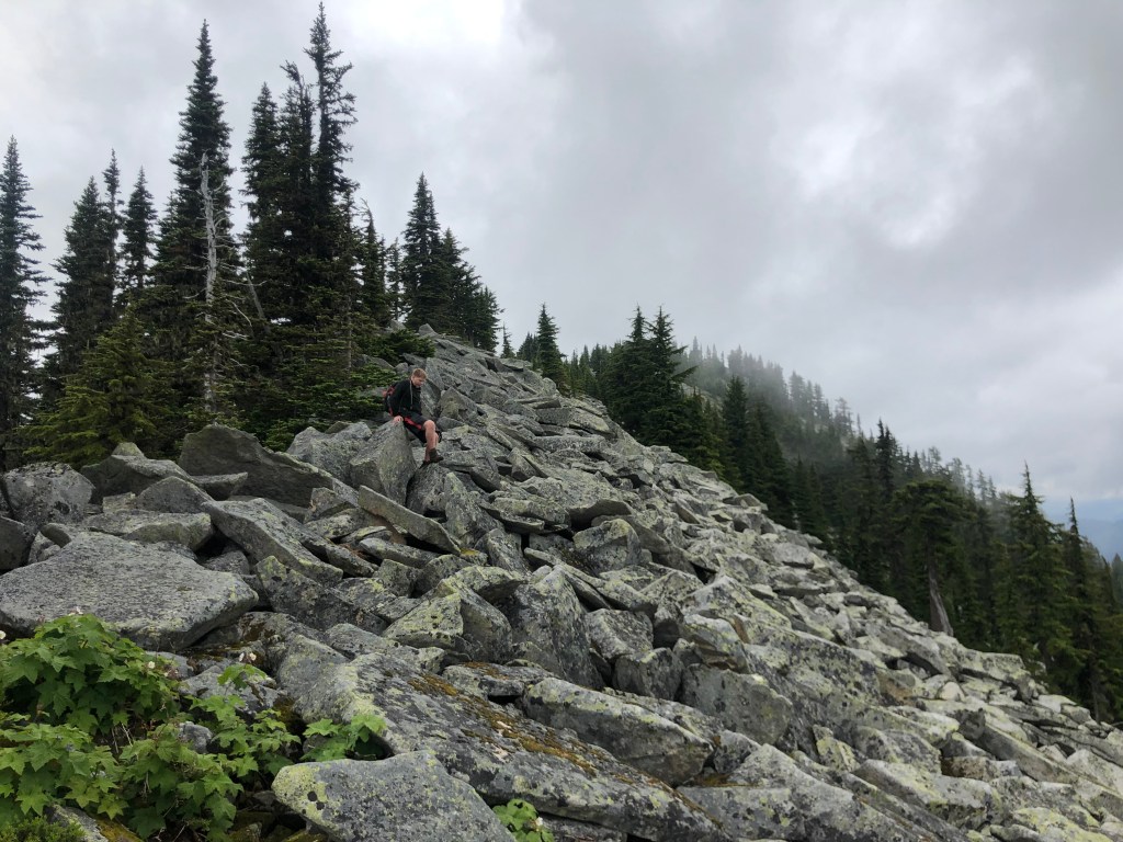
As we intersected the Nook Trail I observed on the map a feature called Talus Rocks. Now talus generally refers to large rocks and boulders at the base or side of a mountain. When I think of talus, I envision the photo below I took from Pratt Mountain as I took my youngest son Rhone on his first and last scramble in 2018.
Chad and I hiked a couple of hundred yards and encountered a garden of glacial erratics – giant boulders the size of houses that were moved by the glaciers when the Puget Sound area was covered in ice. These are indeed erratic as one wonders how did such a large, random, obtuse rock end up here – as if placed by ancient giants. I thought that this was a pretty cool feature on Tiger Mountain and was glad to have descended a different route to see this in person.


By now we had only an easy trail out to the car, so we picked up the pace as I think we were both getting hungry. Fortunately, it was midweek in the afternoon. I expect that on weekends and especially in the summer this area can become rather busy – like Mailbox Peak on a Saturday sunrise.


Know I’ll be back Tiger Mountain to continue my new project of coloring in all your trails on my map. Chad, thanks for #hikingwithhadland, and let’s get out again soon. Cheers, #thehad.