
Title Image: “Where the Mountain Casts It’s Shadow”
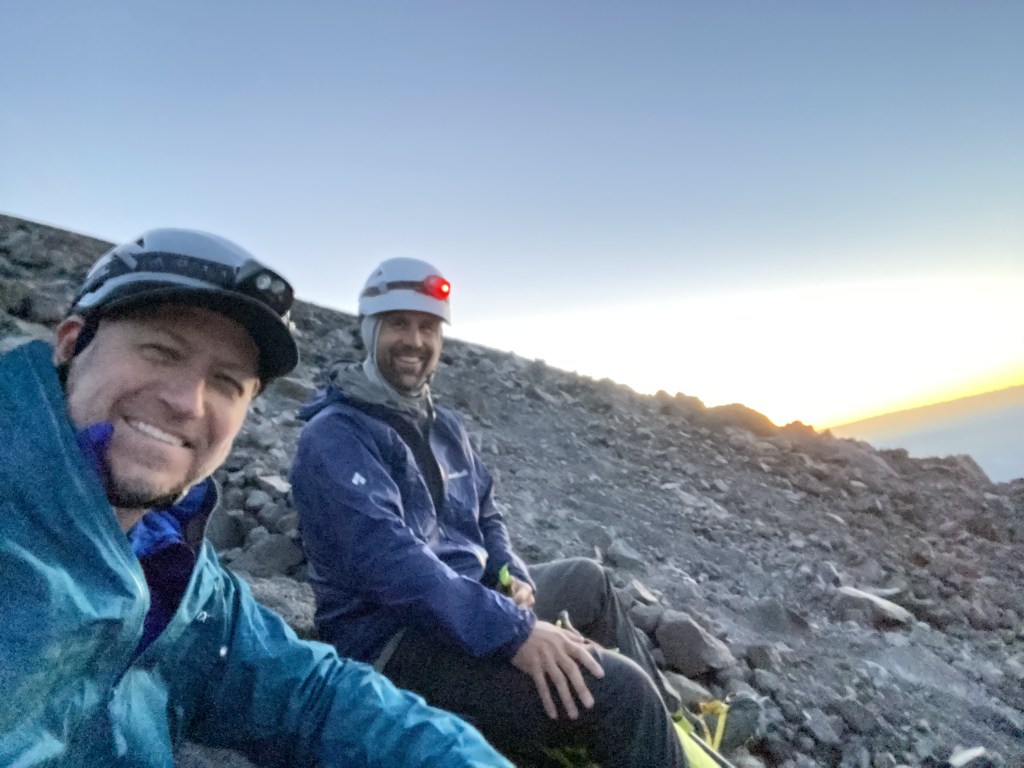
What a great way to celebrate our Nation’s Independence Day by climbing a mountain. Not just any mountain, but Mount Adams, named after our second president, and also known by some Native American tribes as Pahto or Klickitat. I teamed up with my frequent climbing partner Benson Miller and his son Miles and friend Sam to attempt the second highest peak in Washington and also a Bulger and one of the five volcanoes on the Mountaineers list.
I first climbed Adams in July of 2019, but only to Pikers Peak, short about 500+ feet from the trust summit. That day I was with my friend CD and it was 5 PM and we were the last remaining climbers on the mountain. The descent presents the option of using glissade chutes to descend quickly – think of ice-made water slide chutes which help you descend 2000 feet in a matter of minutes. As I was not familiar with this descent, we were alone at 11,600 feet, and possibly waning daylight, CD and I opted to not make the true summit, so this was some unfinished business for #thehad.
We made our way to the mountain and stopped in the town of White Salmon, where we enjoyed a pre-climb meal at Henni’s Kitchen and Bar, a great little bistro that would make a killing in any city. I enjoyed a burger, some fries, and a large cup of coffee to help fuel me for the evening’s climb.


After dinner, we made our way to the trailhead. I was concerned that on a holiday weekend, many people would share our idea of climbing on the 4th of July. We drive up the rough, long, washboarded, FS-80 road to the Cold Springs Campground trailhead, arriving after dark and fortunately had plenty of parking options. After spending a fair amount of time getting ready we finally hit the trail around 11:15 PM, hiking in the dark.

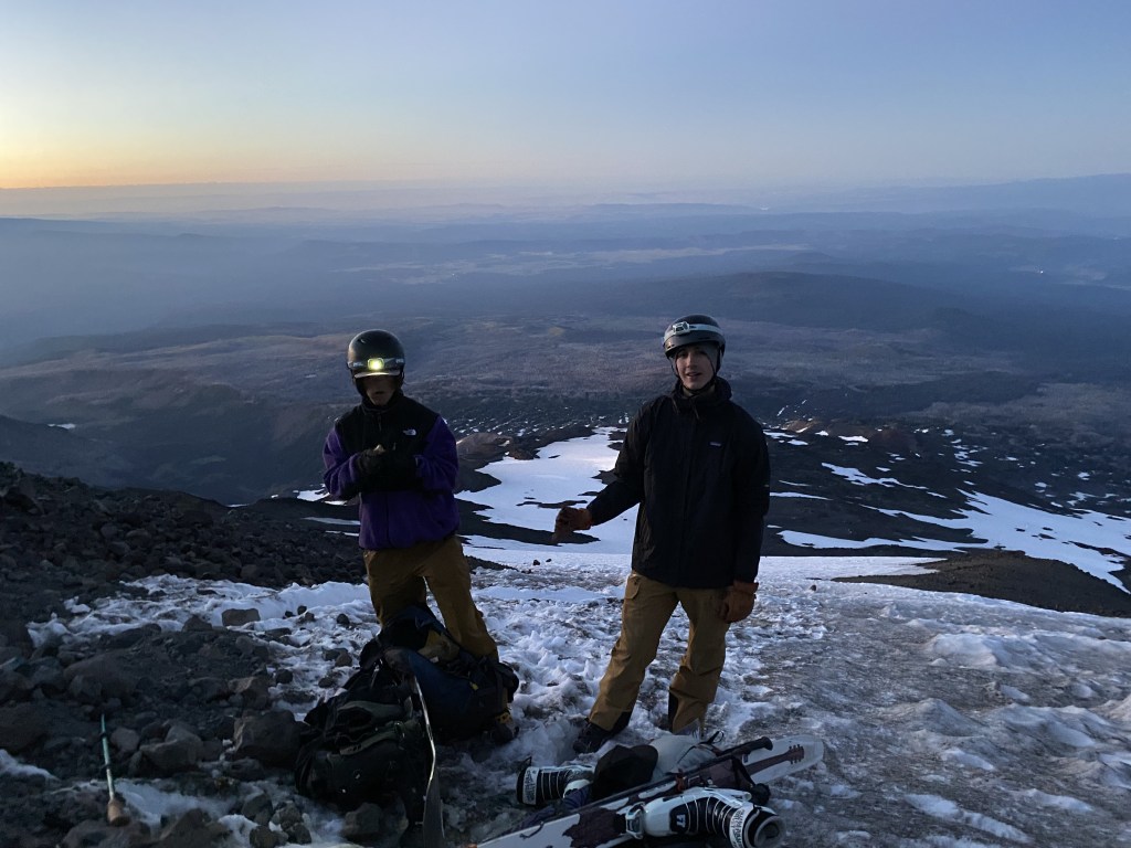
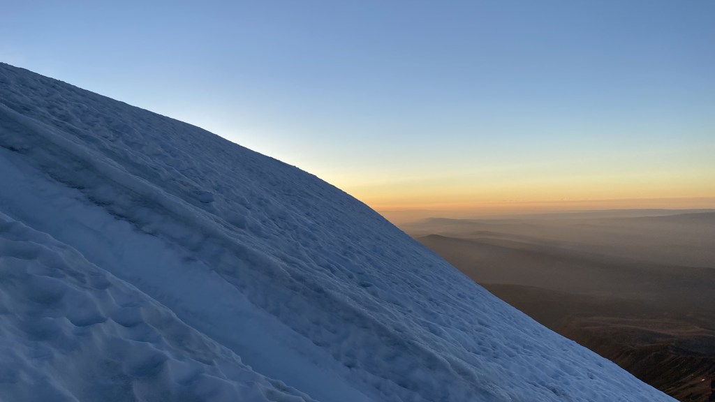
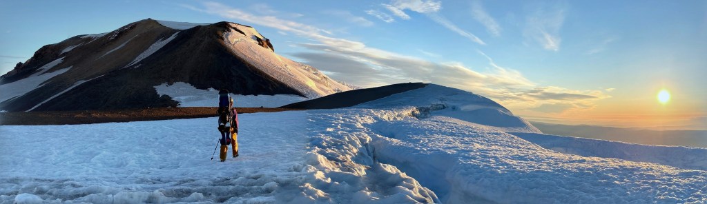
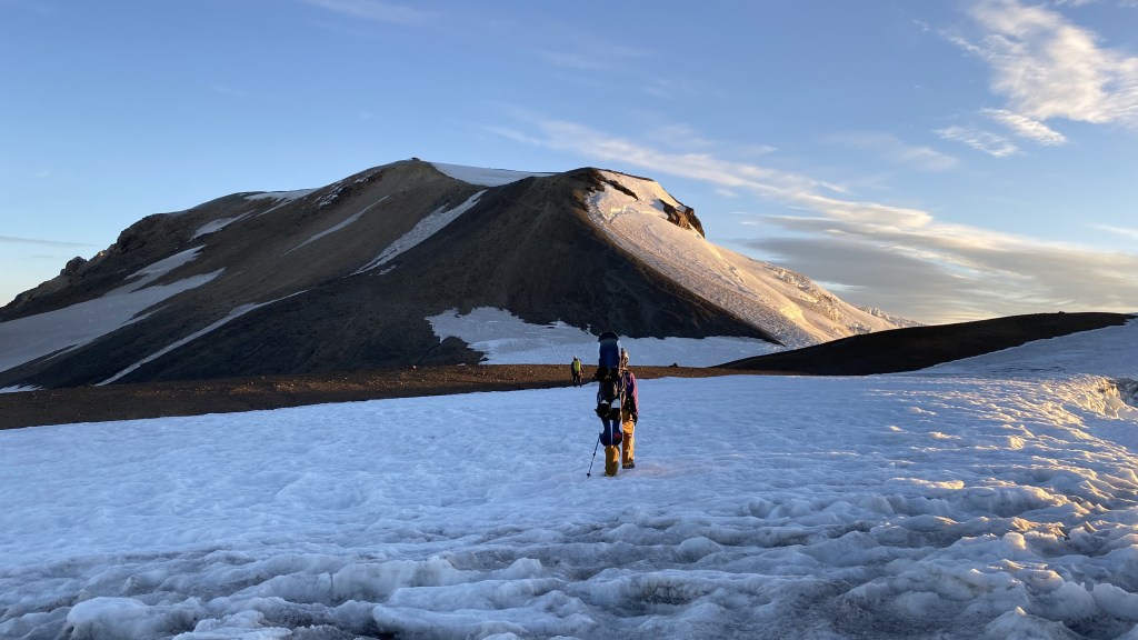
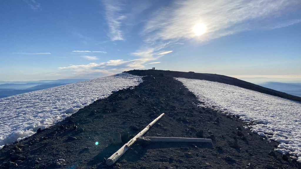
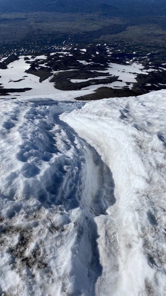
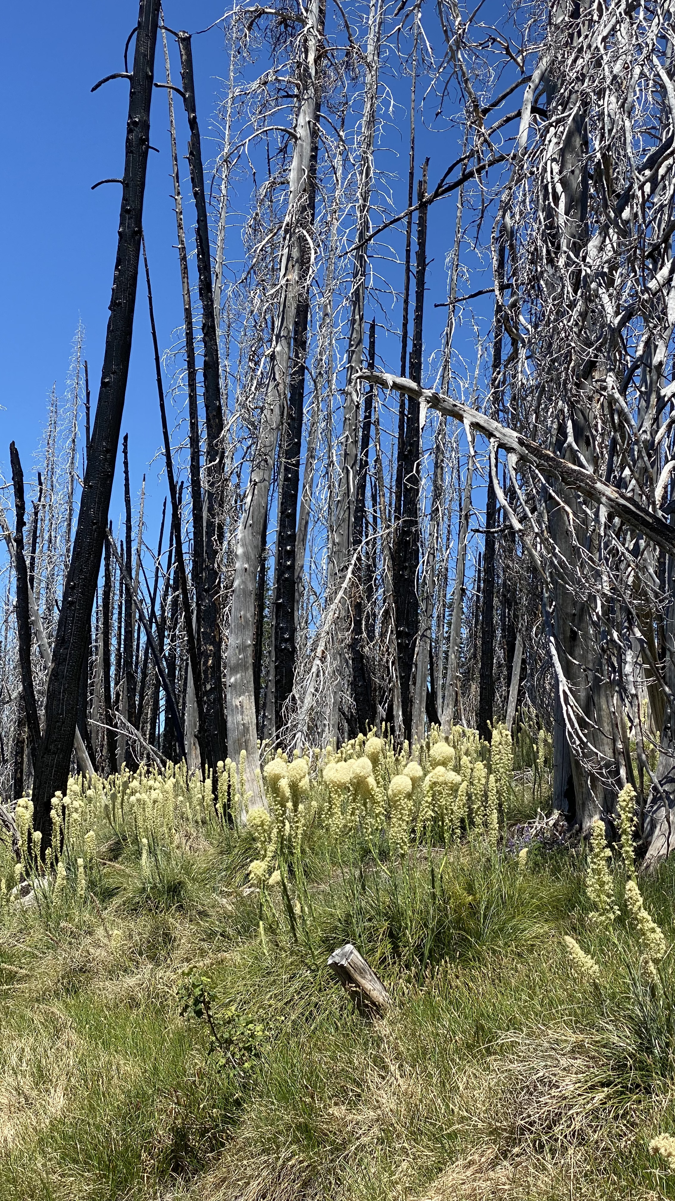
We made good time up the tail in the dark, hiking under a clear sky, with only a sliver of the moon visible. Hiking in the dark also provides a lack of photo opportunities, so there were fewer pauses than my normal climbs. We crossed Morrison Creek and followed the large rock cairns with poles that usually guide the way when the trail is covered in snow. We made our way up to the ride up a snowfield, prematurely donning traction for a short 200-foot snowfield, and picked our way upwards through pumice large and small. As we hiked about 8000 feet, snowfields appeared along the path – we opted to keep left of these mostly, keeping to rock. In retrospect, it may have been faster to don spikes and take the snow upwards. Regardless, we made good time and arrived at the Lunch Counter after three hours and 45 minutes of climbing, the typical overnight camping spot. We saw a series of headlamps making their way at various altitudes and many folks stirring in their tents, preparing to climb. We took a long break, changed into crampons and microspikes, switched poles for axes, and set forth up the dreaded, steep, and long 2000 foot snowfield leading to Pikers Peak, the false summit of Mount Adams. Hiking up the snow face, we encountered many parties, all vying to get to the summit in time for sunrise. It took us about 2 hours to crest the final snowfield to the false summit. This year the heat melted out much of the snow, faster than usual. The glissade chutes that span the entire length of the snowfield had about a 500-foot section near the top completely melted. This year one could take to the rock and climb much of the way to the false summit, and there was hardly any sun-cupped snow formation compacted to two years ago. As we climbed, we chatted with several of the other parties and enjoyed the camaraderie and mutual suffering of this section of the climb.


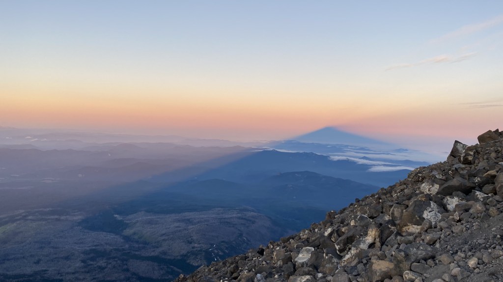
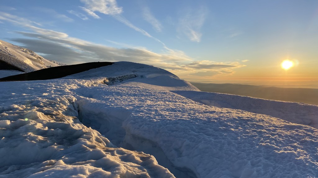
I have only seen mountain shadows in photographs and was hoping to experience this effect today. Fortune smiled upon me and I was greeted to a beautiful sunrise show of the sun casting the shadow of Mount Adams against a hazy morning sky – truly one of the more magical phenomena I have experienced in the mountains. I simply could not get enough of the view and it changed by the second as the sun continued to rise.


After nearly two hours of climbing and enjoying the sun illuminating the eastern horizon, we finally crested the ridge to the false summit of Pikers Peak which is actually a bit further ahead and off to the east of the summit path.


We made our way across the broad summit plateau, presumably where they used to land aircraft to deliver mining supplies. Mount Adams has an interesting history of mining. Somehow not only did they land planes at the summit, but they also had mule trains travel to the top to deliver supplies. I cannot imagine cajoling pack animals to the summit on the plateau. As I have climbed more over the years I have researched and learned more about the history of the places and locales I visit. Mining played a large part in explorers forging paths to steep and treacherous terrain – all in search of riches. Foresty also was significant in the exploration and exploitation of the land. Adventurous fishermen also set paths to high alpine lakes. Each area I visit has such a storied and varied history and I enjoy learning a bit of the newfound riches I discover with each adventure.
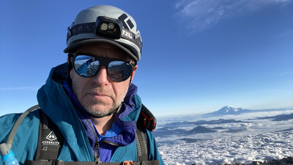


Finally, I made it to the summit and was able to visit the miners’ hut. I personally find such history so interesting and was glad not only I made it to the hut, but that it was exposed. The recent heatwave melted out the snow much earlier than normal, as in some years it is not until late summer that the hut is even visible, let alone fully exposed. I took about an hour’s nap here, shivering in the wind, yet warmed by the sun.


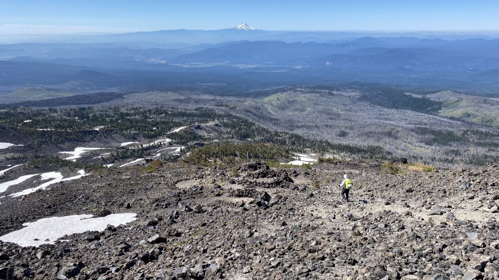
More summit views – most of the Cascade volcanoes were visible: Rainier, Glacier Peak, St Helens, Hood, Bachelor, Broken Top, Jefferson

After spending two hours on the summit, napping, exploring, taking photos, and enjoying the area, we opted to descend. Most of the sunrise parties had departed or were in the process of leaving, and other later parties were beginning to arrive. I was very glad to have climbed during the night, avoid the heat, and enjoy a sparsely populated summit.


The images above were taken two years apart, the left was on this trip, and the right two years ago. This rock resembles a throne and I enjoyed the views for a few minutes.
Our plan down was for the boys to ski and snowboard as far as they could, Benson and I would tag Pikers Peak true summit and take the glissade chutes down.
The chutes were a bit spicy, as in hard and fast. Plus the upper chute was bare rock after about 200 feet and had about a patch of 500 feet of volcanic pumice before resuming down to Lunch Counter. Benson and I took off…..We made fast time down, sometimes it was difficult to control the descent and I had to ice axe arrest a couple of times to stop, but we made good time down. I hit a peak speed of 32 MPH on the descent, sliding down on my ass…Two years ago I hit 54! If you look really close in this photo, you can see the climbers below, looking like ants in the distance – this gives you some perspective of how much higher up we are!


We made our way down to the car 12 hours after we started and made our way to Hood River to enjoy a hearty late breakfast at the Egg River Cafe. Another great climb with Benson and his son Miles. Cheers, #thehad!
https://www.alltrails.com/explore/recording/mount-adams-summit-115c343
Mark – great summit with you and exceptional photographs from the trip. That pano of Miles below the final summit push is extraordinary.
Truly Inspiring ! Thank You !
( I recently lost my Left Eye in mugging/accident/incident = now half blind : Your post & story here, with your Friend & Family, inspired me in the best of ways to get up out of bed & go Living Once Again = now walking/jogging around the neighborhood : I’ll be hitting The Trails next : Hiking this beautiful State that I Love ❤ !!! ) Thanks Again for True Inspiration : You have touched my heart!
Karl I Matthiesen
Mark, great report and excellent pics. A few corrections to your narrative if you don’t mind.
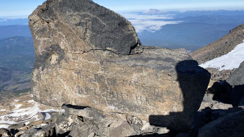
The structure on the summit dome was a forest service fire lookout. Manned for about 10 years in the 1920s. There was actually mining, sulfur I believe, on the summit area, and donkeys were used to haul up and down the mountain. Occasionally you can come across some aluminum wires in the rocks leading up. These were used to clip the donkeys on, to keep them on track up and down. In my home office I have two old weathered wood spokes, from a wagon they used for hauling ore, which I found in the rocks at the base of the south spur. The rocks on the false summit were chiseled by one Arthur Jones. The one in your pic says “this rock was struck by lightning Aug 21 1923”. Not 1999. You can actually see the burn mark of the strike, on the top edge of the rock. Directly opposite of that one, Arthur also inscribed, “If you stop here you are a Piker. Don’t crab the mountain was here first Arthur Jones Aug 27 1923.” This is how the name of the false summit was informally established. (Presumably, Arthur had lots of free time up there to do all that chiseling!)
Since mining was suspended up there in the early 30s, I highly doubt that aviation was advanced enough to permit routine, or any, landings on the summit or the plateau east of Pikers Peak. It was all manual back then.
Cheers!
Pete Clement
Gig Harbor
I did some additional research on this, thanks to Fred Beckey’s climbing guide and Wikipedia, and here are some corrections to what I myself commented.
The lookout house was abandoned for its original purpose but WAS later used by miners and other workers on the mining venture. Apparently the structure was added to with a lean-to, to accommodate more who bunked there. There WERE some airplane landings on and near the summit. These occurred in the 1950s as the mining developer sought to use aircraft to transport the sulfur off of Adams.
The rest of what I posted is quite true, as I have seen and photographed the rock inscriptions several times over the years. Apparently Arthur Jones was one of a small party which built the original fire lookout building.
Pete Clement
Hi Pete, thanks for the additional information and the correct date on the rock inscription. Cheers