Cover photo: #thehad making his way up the final scree gully to the summit of Mount Ellinor

The backstory
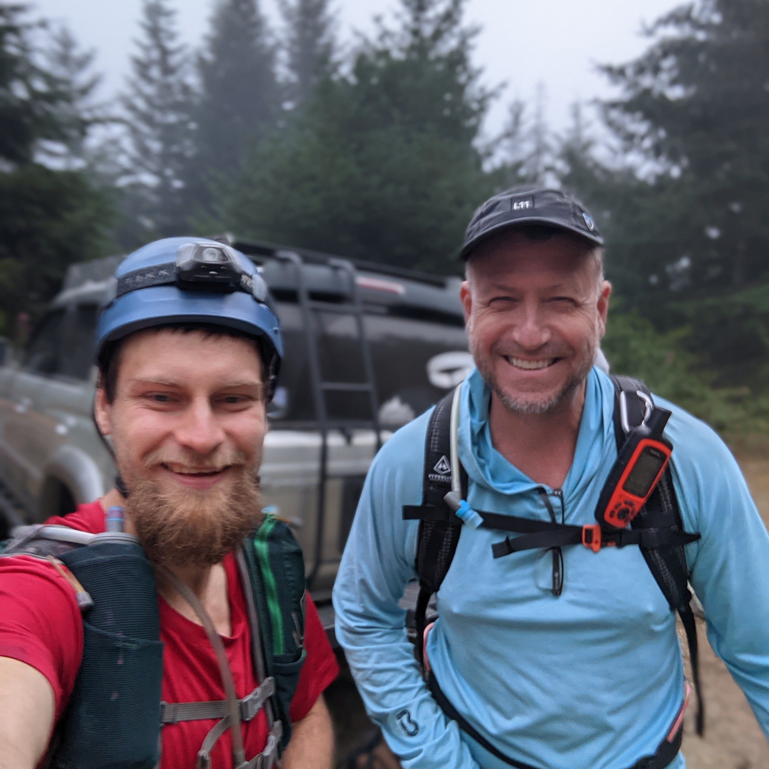
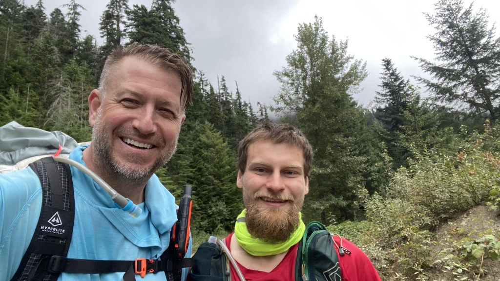
Saulius Braciulis and I met on PNW Peakbaggers after both having completed the North Bend Triple,
North Bend Triple 04-24-2021
He is an ultra runner/ultra pedestrian and has a passion for running, especially ridiculously long distances, like 100 mile+. We became friends and earlier in the summer ran the Zion Traverse, a 40-mile trail spanning Zion National Park.
Zion Traverse 06-05-2021
Since that great trip, we have been trying to schedule another event – hike, climb, long-distance trek. Somehow we settled on the traverse theme, this time planning the Mount Washington – Ellinor traverse – a short but steep climb and ridge traverse of two peaks in the Olympic Mountains near Lake Cushman. I had climbed Mount Ellinor this past winter and found it to be beautiful.
Unfortunately that day the mountain was socked in clouds for most of the day, sad as I have seen and read about the beautiful views of the lake, Puget Sound, and the surrounding mountains – with even Seattle visible on clear days. I was excited with the opportunity to take on another traverse with Saulius and the possibility of views this time. The forecast called for cloudy weather with a 25% probability of rain. This would make travel on rock tricky and risky. I picked up Saulius promptly at our agreed-upon time of 3 AM and we made our way to the Olympics. Upon arriving at the trailhead after a 3-hour drive, it was cloudy. Like last time, there would be no views. I still have no idea what these peaks look like!
And so we begin!
The Mount Washington trail is considered a difficult trail – less of a hike and more of a scramble up a rocky rooty boot path gaining over 3200 feet in under two miles – it is steeper than both the infamous Mailbox Peak and the Kamikaze Trail on Teneriffe in the Northbend Washington area. This is not for the faint of heart.
He hit the trail at 6:53 AM. Although it would be cloudy and misty throughout the day, I was hopeful that the rain would remain at bay, as we would soon learn our path would take us through some challenging scrambling. As advertised, the trial lost no time in gaining altitude, and went up very steep out of the gate – I immediately began to sweat and knowing that there would not be many sources of water on the trail, hoped I could manage my hydration with the pace.


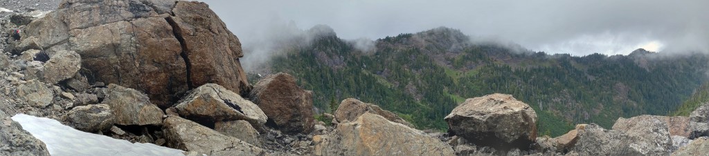
The trail climbed un relentlessly upward. We would take over an hour to gain a mile but climb well over 1500 feet in the process. Fortunately, after around the one-mile mark, the elevation gain abated for a bit and the terrain opened up into a more gentle and open basin – I suspect the mountain and views were beautiful. It shall remain a mystery.
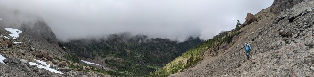
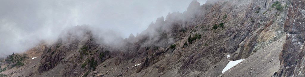
Into the Mist
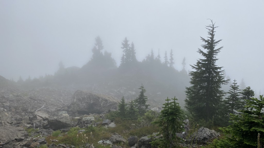


As we continued our upward climb, some nearby views of the cliffs of the mountain were barely visible, diaphanous in the misty clouds as if teasing a future reveal. Large rock formations became visible like leviathans from the deep.


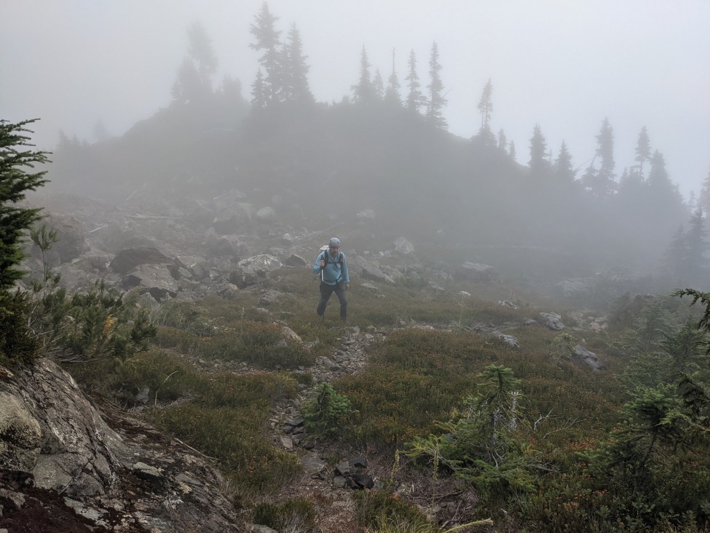


We climbed up the basin, the trail formed by a rocky pathway resembling escalators, stairs, ramps, and sheer cliff walls. It was very beautiful albeit with our limited visibility.
Ascending the rocky slopes


As we made out way above the treeline and increasingly steep rock, we took the opportunity to take more direct paths up and get some scrambling in – a good call as later we would need our best scrambling skills to make it out of the basin.


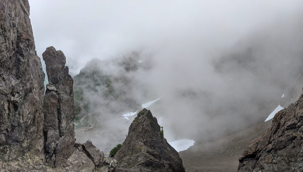
We ascended the path which has a well-known rock ramp up near the saddle of the peak of Mount Washington and the ridge. Many rock formations and gendarmes were visible in the misty distance, the ridge resembled the spine of a Stegasaurus.


Once we gained the saddle, we knew the summit was only a couple hundred feet in elevation and maybe 1000 feet in the distance. We made our way up the faint path, wrapping our way around a steep face along a very narrow path, hugging the rock as we may our way to the summit block.


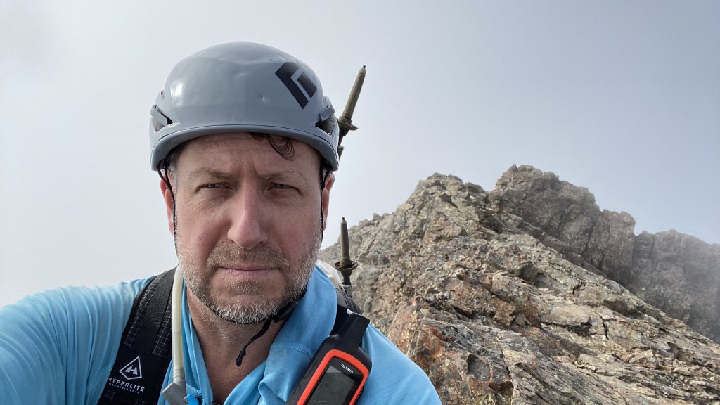
Finally, we rounded the summit block and double-backed to gain the true summit.
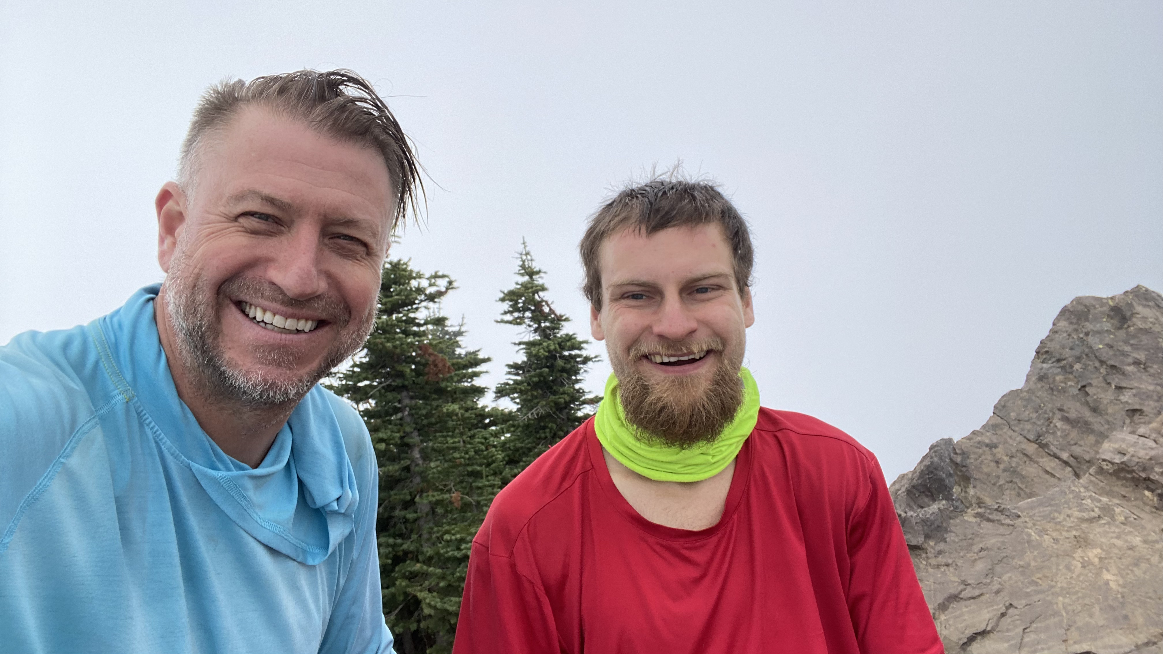
The Summit


With the first part of the traverse complete, we make our way back across the Washington summit ridge to the saddle to assess our plan of attack to begin the traverse to Mount Ellinor.
The Descent


The traverse
We commenced the traverse by returning to the saddle. It seems that the obvious way to begin the traverse would be to drop into the basin which was to the right of us on the west side of the ridge. This however in retrospect was not the easiest route – by descending the main trail a couple of hundred feet, one may find a more gentle Class 2-3 ramp bypassing the immediate highpoint of the ridge, leading to a manageable gully. Our route led to some Class 4 exposed waling on a narrow ledge – the holds were well sized, however, the rock in this area is utter crap and we had to test nearly every hand and foot hold to ensure that it was solid, otherwise a fall was likely, and given the exposure and heights it could be fatal. This would be a common theme climbing the rock along this route.


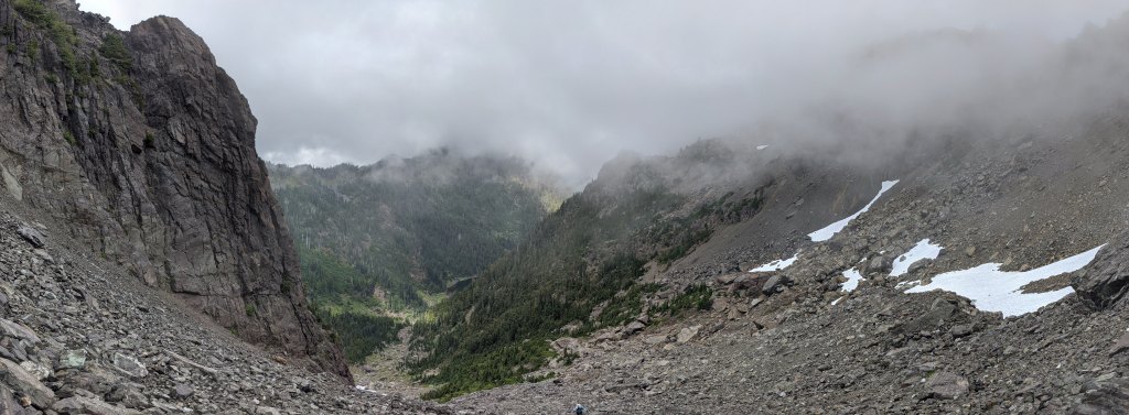
We dropped into the main basin and began our traverse, laterally across the rock. Our route had us traveling about one mile to the base of the Ellinor summit gully. Our path took us down a gentle downslope. Some of the terrains was nice, sticky, slabby rock, however, there was a sea of scree and talus covering the basin, dotted with occasional boulders, and sparse patches of trees. This proved for a rather treacherous footing and endless sliding, near falls, kicking down loose rock, scraping dirt off holds, etc., and made for painfully slow progress. It appeared that one could descent a bit lower, go below a rather large island of slabby rock towards the lack, and ascend the outlet of the gully, up more stable rock. Our path led to many slips and falls and bruised ankles and shins.


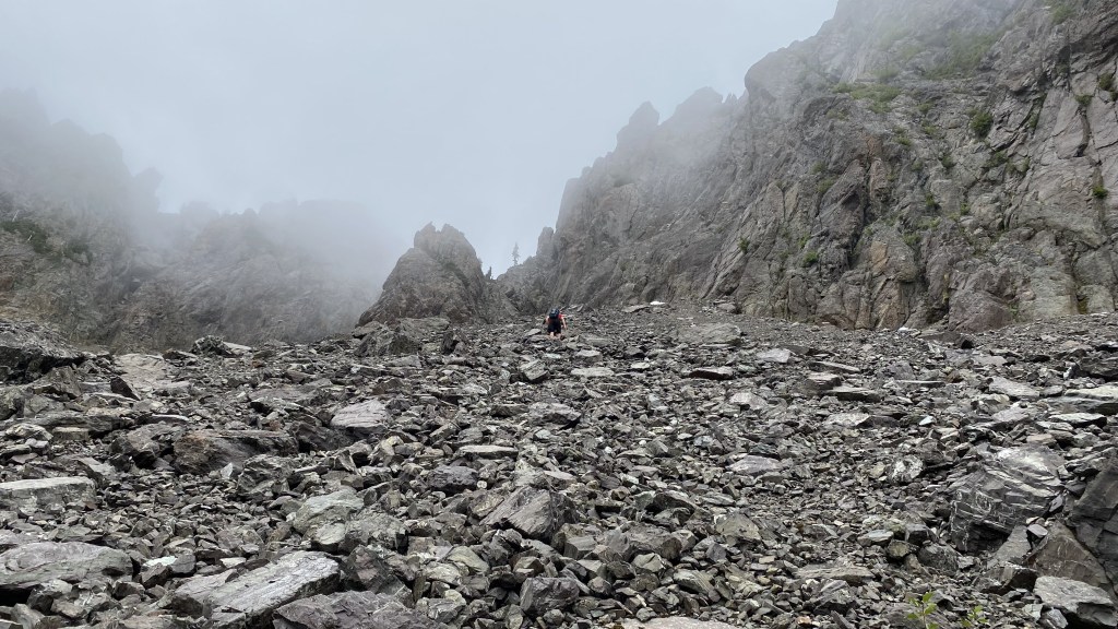
After what seemed liked hours, and may have been, we made it to the based of the scree-filled gully. The only way out of the basin and to the summit of Mount Ellinor. There was no option, except to find a path up to the ridge.
The ascent


And so the problem solving begins…


As with many climbing problems, upon closer approach and inspection, the route often begins to reveal its weaknesses. We encounter a prominent V-shaped rock formation that seemed to bifurcate the upward challenge to a rocky, steep scramble up a series of stacked gullies on the right, and a long scree gully to the left. It was a toss-up of what was less desirable – Saulius was tired of the scree and wanted to climb. The route to the right, although more technical appeared feasible from my vantage point, so we approached the base of the gully and began to climb.


We scrambled up the initial pitch – it was steep and exposed and the rock was loose – I had to check every hold and every foot placement – a fall would have been very bad. The pitch topped off to the left of the center rock formation. I mantled up and mistakenly thought this was leading to the final ridge – I was sadly mistaken and was at the bottom of another gully, only this one was steeper and more technical – I had no option except to continue climbing.


After some tough climbing, careful to ensure my holds were solid, I finally exited the top of the gully. I was relieved to see a steep scree field to the left – the right presented another 200+ feet of climbing to the summit ridge – I would have been more comfortable with good rock and even a rope and protection, however, none of these were present and I was relieved to see a safe way to the top.


Final steps to the top of the ridge.


With the crux of the traverse completed, we only needed to descend Mount Ellinor and return to the car. We made haste, enjoying the fact that we were jogging down a well-maintained trail and no longer climbing up the crummy rock.


Panoramas
https://www.alltrails.com/explore/recording/mount-washington-ellinor-traverse-e5abba8
Awesome photos… I actually just painted something based off one of the foggy scenes looking up at the summit. Super cool.
Thanks for the great pics and write-up. I started hiking Mt. Washington 30 years ago next week. I probably have summited it at least 20 times. But a bit over 8 years ago, I developed very severe knee pain on decent that pretty much put an end to my hiking, 8 years ago was the last time I climbed Mt.WA.
That is up till last Friday 🙂 I have been exercising more over the last few years, I also got some good knee braces recommended by a doc friend, and loaded up on Advil. Fridays was a great day temp wise, and turned into one of the more beautiful days I have ever had up there. I was able to make it up and back down with little pain, it was wonderful.
I recognize every one of your pics well, aside from the traverse. I have often thought of trying the trek from one peak to the other, but if I couldn’t find an easier way than what you did, that would be a bit much for me. On the way down, a few hundred feet down from the “saddle” (I have always called it that also), up to the right, there is a place where 2 plaques used to be that commemorated a hiker who died in that area about 20-25 years ago (They have since fallen off, but the glue is still there). A quick 1 minute hike up to those reveals an easy way down the west side. More or less solid rock and what looked like an easy runout. But the real hard part looked to be the assent back up to Ellinor. That might be more than I want to deal with, and if it took you guys over 10 hours…
I have heard there is a relatively easy way to do it, but in a specific direction, and I don’t know which way that is or the path.
On my way up. I passed a coupled guys that were coming down, 1 of them could have been you, the other said it was his 198th assent of Mt. Washington, very impressive. I wish I had kept better track myself.
Also, I was sad to see the journal was no longer up top. Last time I was there, it was nearly full, and I had planned on replacing it and scanning all the pages to put online or something, but that didn’t happen.
I also love that mountain and have summited at least 10 to 12 times each time going a different fun way