
Early this spring I applied for a permit to climb Mount Whitney. I was able to request up to 15 dates. Permits are now issued on a lottery basis, similar to camping permits for the Enchantments in Washington. To give you some idea of the scarcity of the permits, only 60 people per day are issued a day-use-only permit, and 100 for overnight permits, limiting access to Mount Whitney and the Whitney Zone to 160 people per day in total. I was elated to “win” a permit that was issued for June 6th. I had 24 hours of access to the area and one day to climb Mount Whitney. As the date approached, I was inquiring among my circle of climbing friends who may be interested and available. As fortune, luck, and serendipity unfolded, My two good adventure and ultra pedestrian friends Will Vipond and Saulius Braciulis were able and willing to join me, which was rather serendipitous as exactly one year ago to the date, the three of us completed the 40-mile Zion Traverse in just under 20 hours. That was Will and my longest continuous activity! We would set a new record on this Whitney trip.
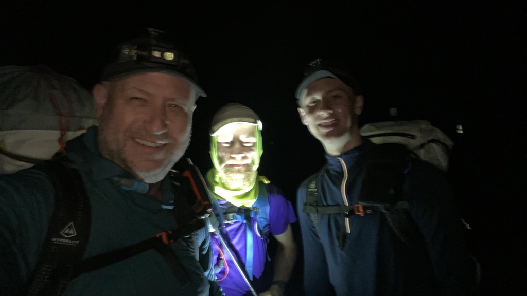
We flew into Fresno and for some unknown reason, I thought the drive from Fresno to Lone Pine where we would spend the night prior to climbing was 90 minutes away. In actuality, it was a 4-hour drive. This cut into my planning schedule and we would end up getting into town in time for dinner, hopefully, and not have a lot of time for rest prior to our planned midnight departure. We rented a new Cadillac Escalade and drove fast. We made it into town in about 3.5 hours, checked in and found a place to eat. Our initial objective was to start around 12:30 AM and hopefully catch the sunrise at the summit. Lone Pine is a very small town. Margie’s Merry Go Round restaurant is now a Chinese restaurant. I found it rather amusing as the sign advertises Bar-B-Q, Lamb Chops, Steaks, and Pies.


I was running on about 4 hours the night before, and after driving, and not sleeping before the start, I was a bit tired out of the gate. Will had flown in from New York, but he is 21 and runs about 15 miles a day. Saul I think ran 26 miles the day before. I was two weeks off my Mount Shasta attempt, still fatigued, still recovering from COVID, and as a result, was not feeling well after the initial flat mile as we ascended. Now relative to many other mountains I have climbed, the gain was moderate averaging 600 feet per mile. Granted the published distance to the summit is 11 miles and about 6400 feet of gain, and the climb starts at over 8000 feet.


We made good time in the initial three miles, averaging just over 30 minutes a mile. We reached Outpost Camp in just under three hours and had gained 2000 feet and 4 miles. About 1/3 of the elevation gain and distance. I was stumbling at this point from the lack of sleep and made the executive decision to make an unplanned bivy and take a dirt nap. I knew that if I did not get any sleep I was not going to make it.


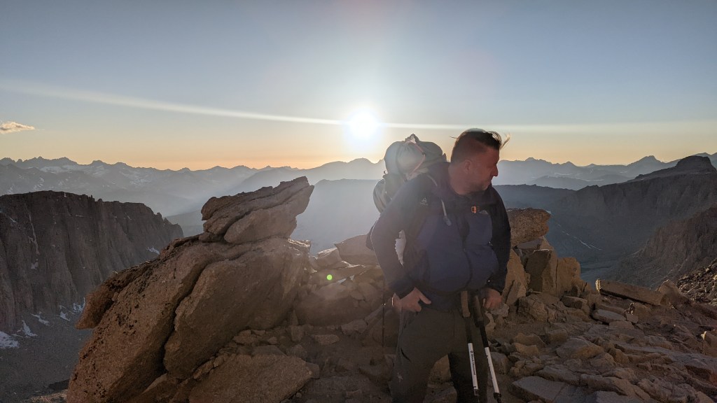
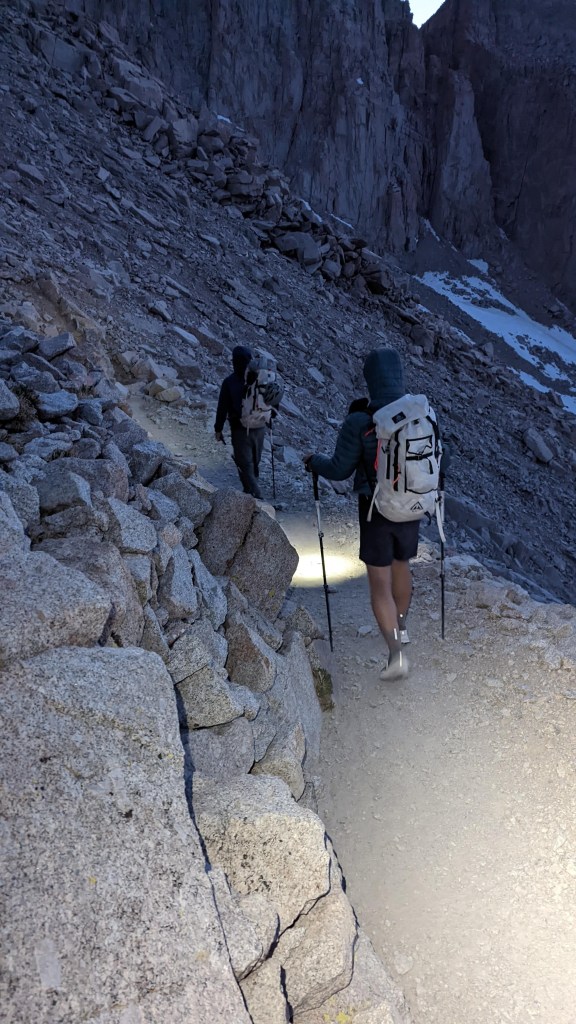
We slept pretty soundly for three hours and were woken by other hikers passing us by at first light, #mothbear! We finally got up and on the trail about 5:30 AM and were greeted by the dawn light making its way up the Whitney Portal.


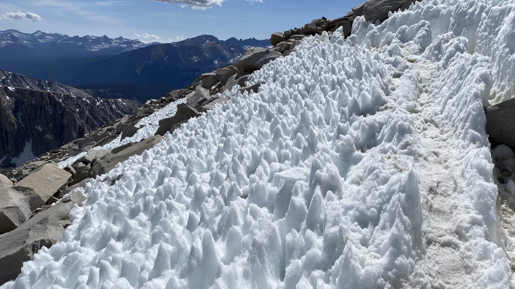
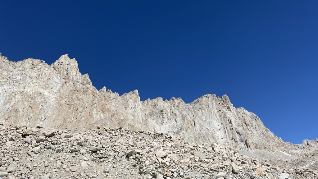
As the sun rose, the granite sentinels surrounding us glowed white in the sun. It was a rather spectacular introduction to the narrow valley that would lead us to the upper basin.


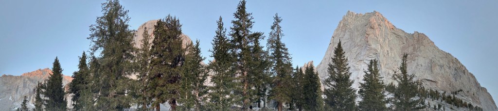
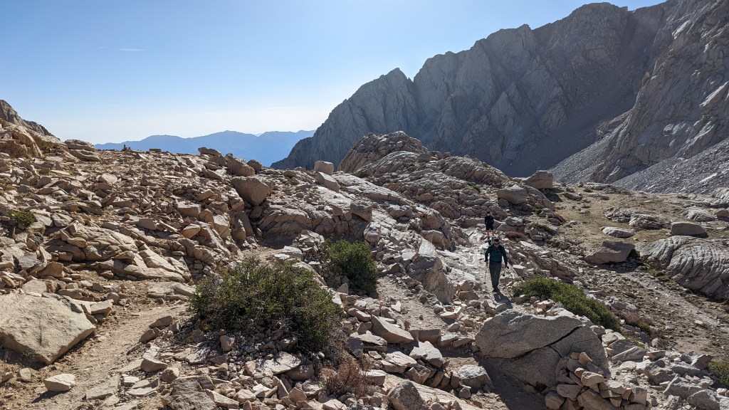
The trail soon shot upwards, climbing the granite stone, and wound its way up the rock formation between the old sequoias.


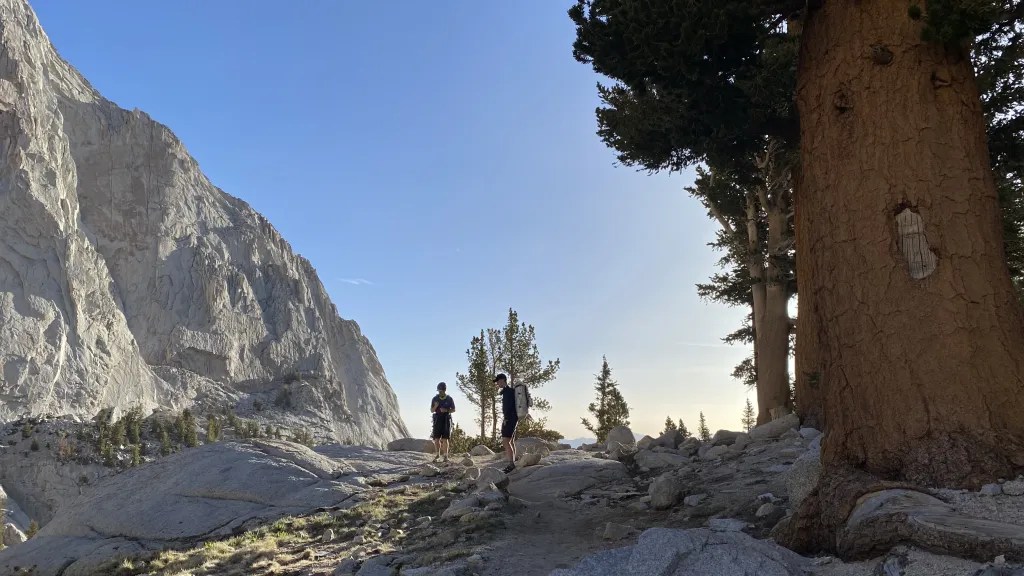
We climbed the slabby trail that was carved from the granite. This was especially fun as it was rock vs trail, grippy granite, and terrain unlike Washington state save for The Enchantments.


The sequoias are tall, beautiful, gnarled, and old. We climbed the granite knoll which would provide access to the upper plateau area north of Consultation Lake. Here the trees disappeared around 11,000 feet. I was amazed at the amount of vegetation at this altitude – something we do not see in Washington.


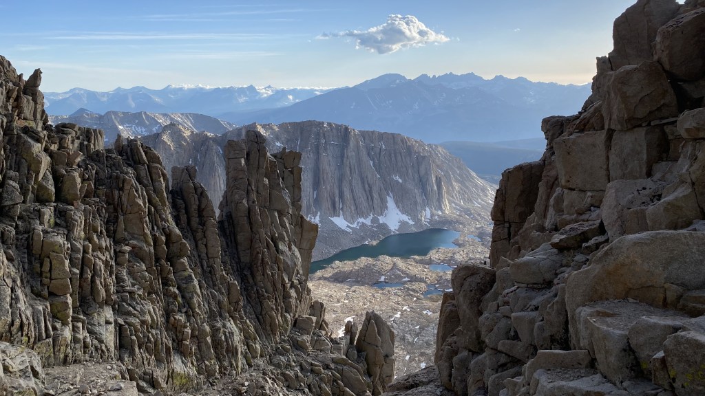
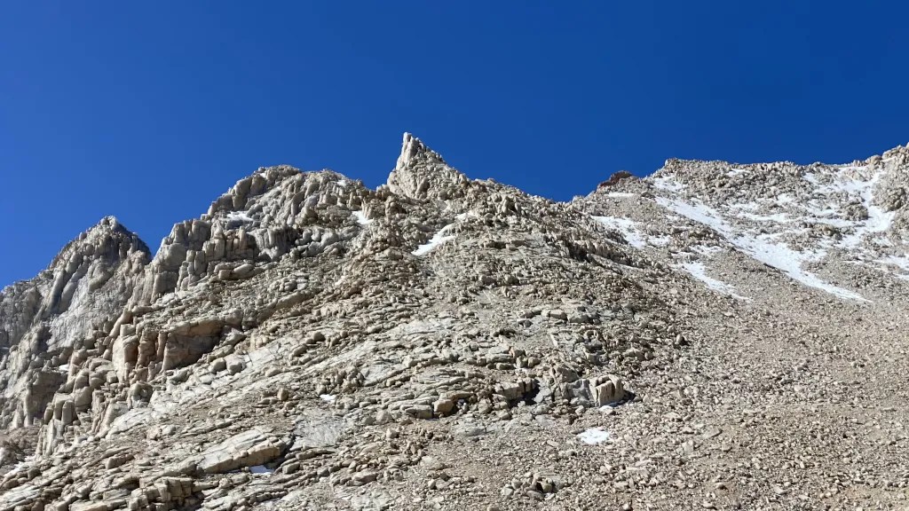
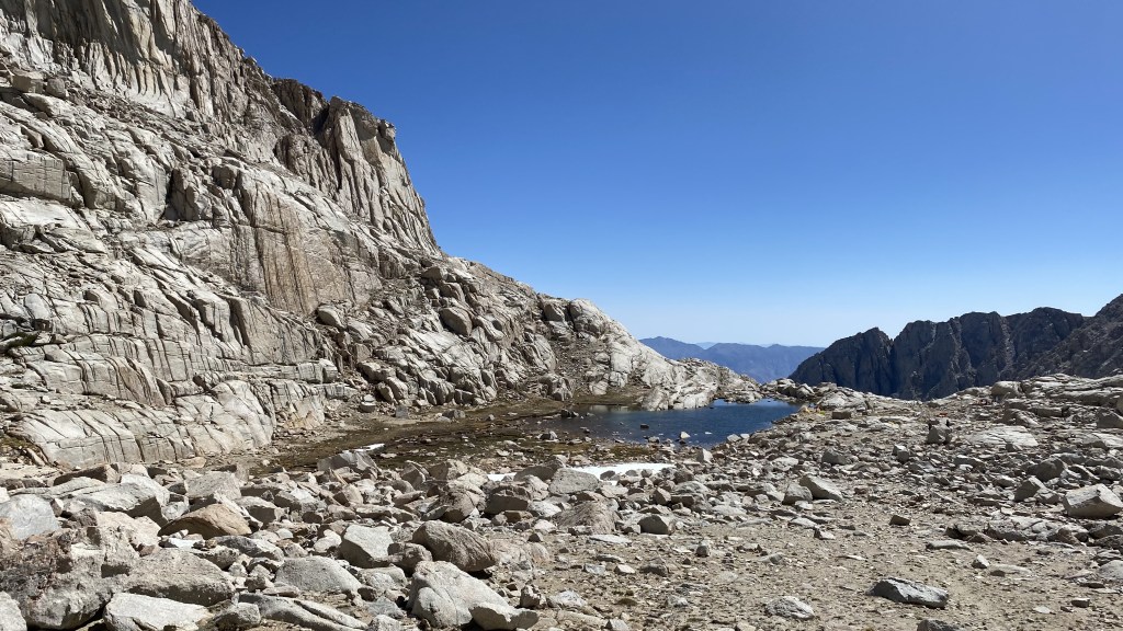
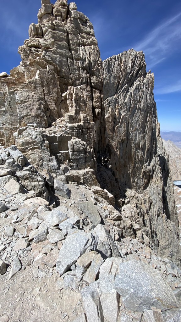
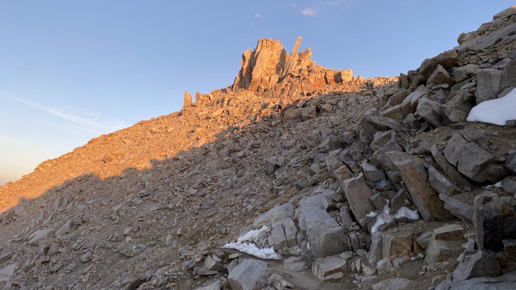
From here onwards, we would be above the treeline and exposed to the sun. Heat exposure and water management were not a concern, but something we were well aware of and needed to be mindful of. It was in this area that Wotan’s Throne, a cool scrambleable formation came into view. Saulius and I had aspirations of climbing this on the way back. We were behind schedule due to the nap, and clearly missed any summit sunrise. I was moving slower than usual. We also planned to hit the Needle summits all along the summit ridge. Well, now I was thinking maybe 3-4 which were above 14,000 feet.


We hiked in a somewhat flat area, gradually scaling a granite formation on a trail carved from the rock – this was a really fun section to climb in the AM. It was a bit less so in the dark. More on that later. We continued onwards walking up the slabby granite to the North of Consultation Lake.


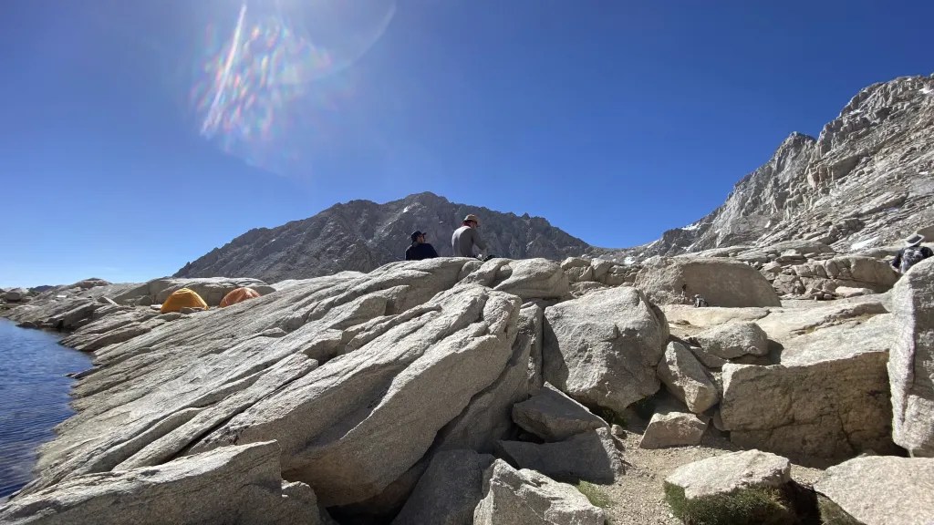
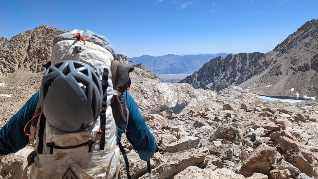
Whitney is a bit of a tease as its not really visible until you reach Trail Camp – the last formal camp prior to the summit. People with multi-day permits usually camp here as its good for acclimitization and not too far from the summit – about 2/3rds of the way. We took a long break here to filter water and helped a couple of other parties who had a broken filter, obtain drinkable water. From here its up the ridge on the infamous 99 insufferable switchbacks to gain the 1500 feet of elevation to Trail Crest – the saddle to the final summit push, intersection with the John Muir Trail and access to Sequioa National Park. I learned that Mount Whitney straddles Sequioa National Park and Inyo National Forest, so I also achieved another accomplishment in my quest to visit all of our National Parks.


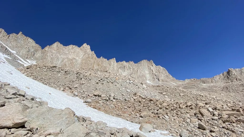


We slowly made our way up the 99 switchbacks. I was moving slowly as I was tired and feeling the thin air. Our slow pace however may have prooved to be a blessing as it gave us a bit more time to acclimatize. Both Will and Saul were feeling it too, with headaches that would not go away. As we made our way up the switchbacks we came across the cables – installed as the trail is narrow and in a no fall zone meaning a fall here would be deadly. Fortunately the snow had mostly melted out. I dont think I would like this section with snow – crampons and ice axes would be needed.

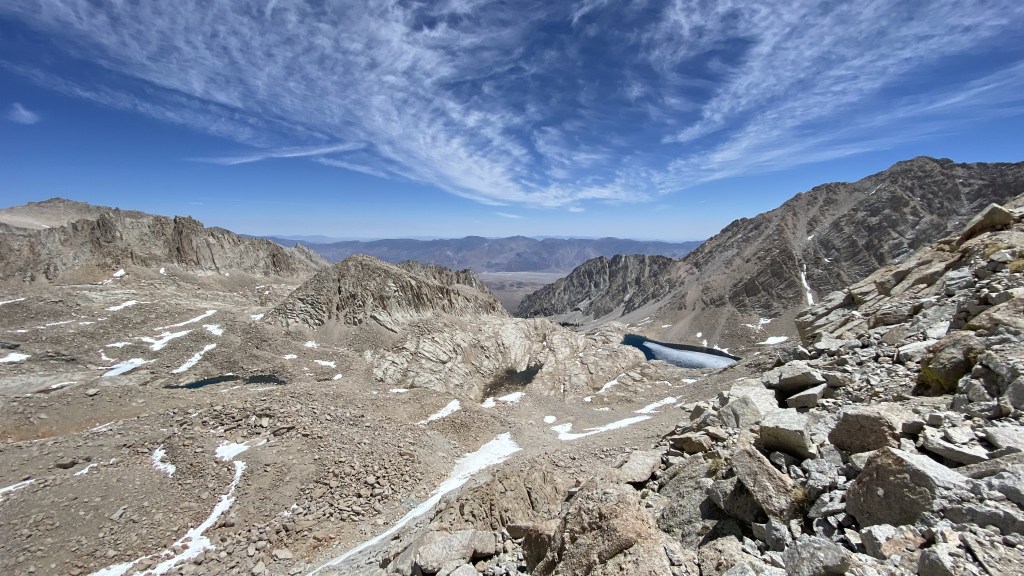
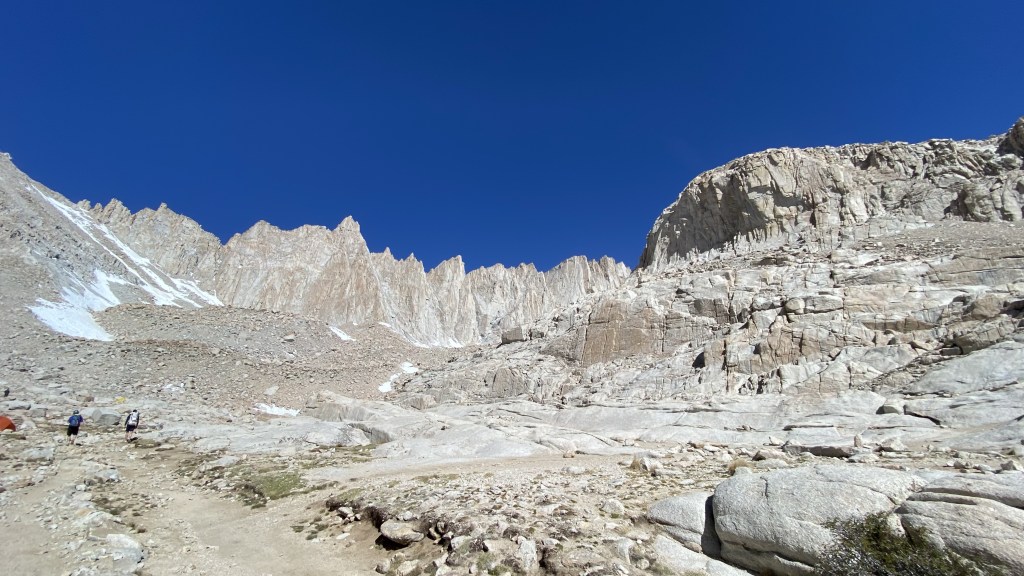
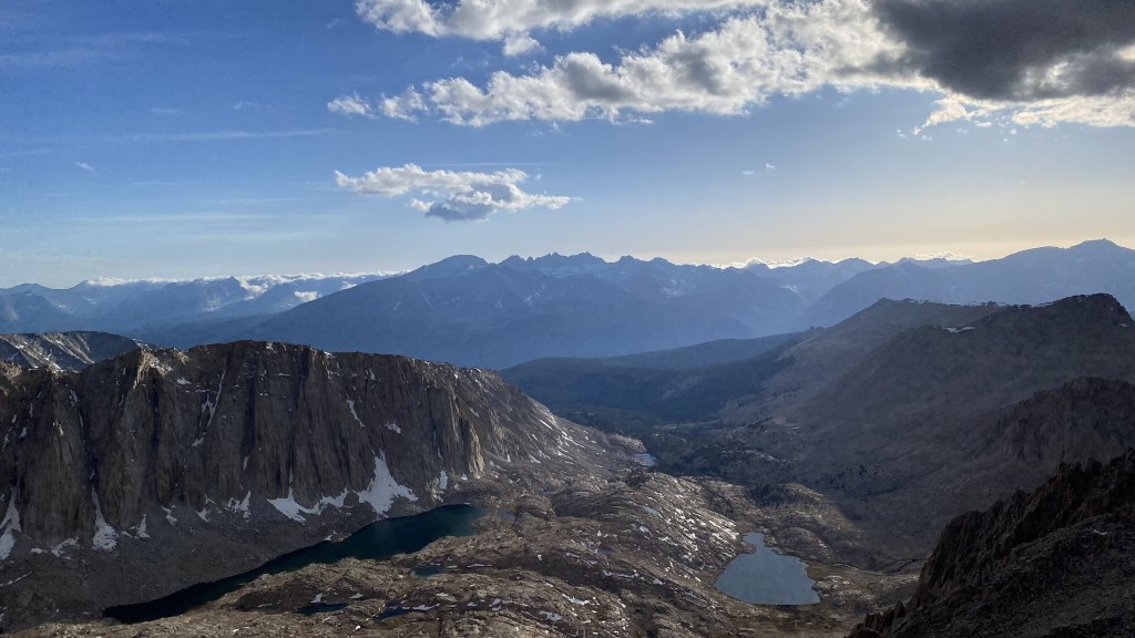
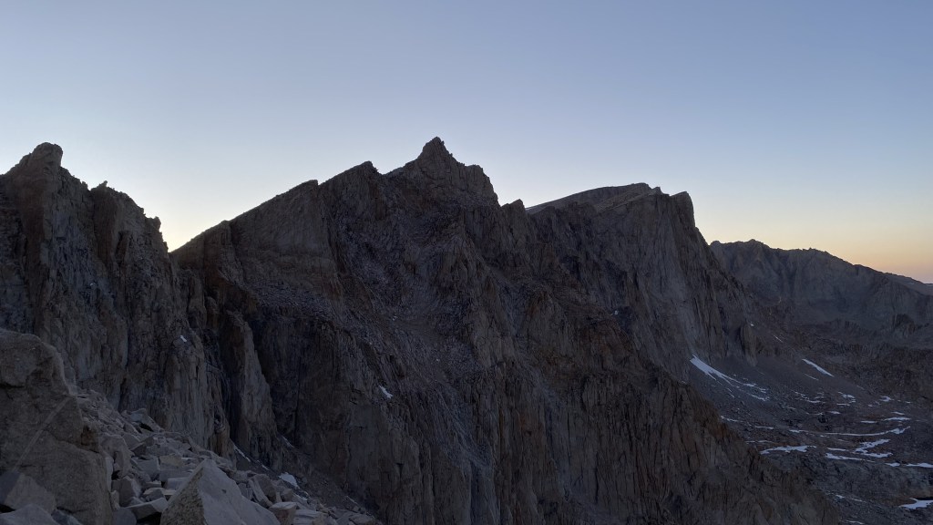
Looking back at the Whitney Portal and all the ground we covered – Consultation Lake is in the right background, Wotan’s Throne mid left, and to the far left is Mount Carrilon. A small patch of sequoias is visible in the cetner. The area is so expansive that one quickly loses all sense of scale. Its amazing we came all the way up that V shaped valley.

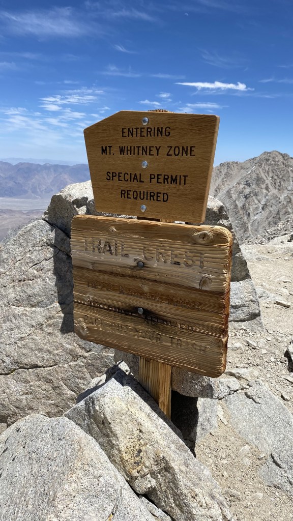
We finally reached the saddle at Trail Crest.

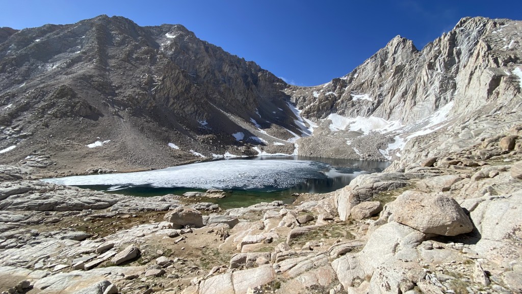
We had expansive views of the Sierra Nevada’s to the West and beautiful lakes in the basin below.


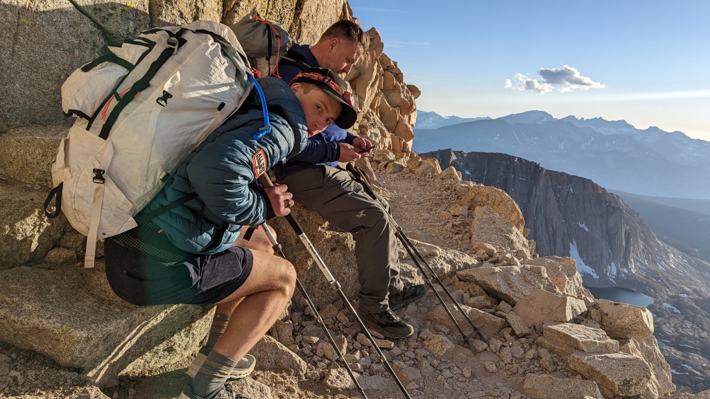
We stopped for a good 30 minutes as the altitide was taking effect. Both Will and Saul were becoming nautious – I had labored breathing. We hydrated and refuelled. Several parties who summited earlier stopped to chat. All had the same advise, the remaining two miles and 1000 feet were grueling, in that most folks don’t know what to expect and the summit is farther than most people realize. Most of these folks were super fit and said it was challenging. Yea Us! Oh and some asshole trail runner said he summitted in 3.5 hours Fuck Him! LOL.

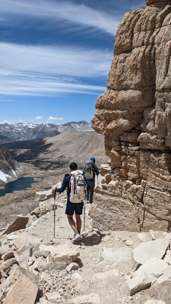


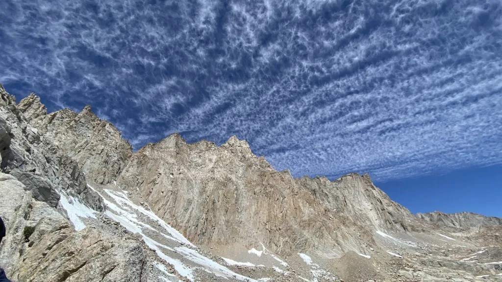
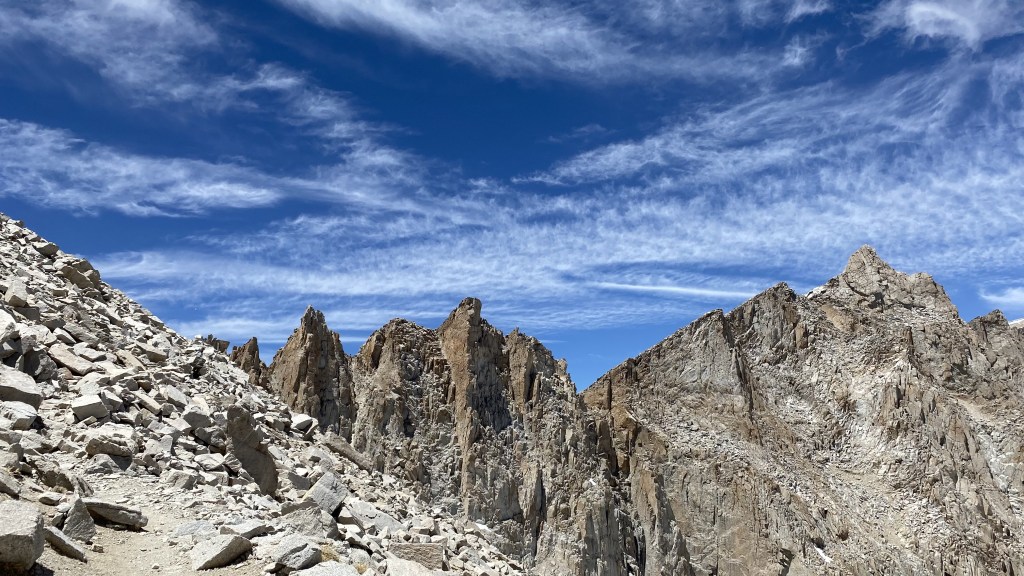
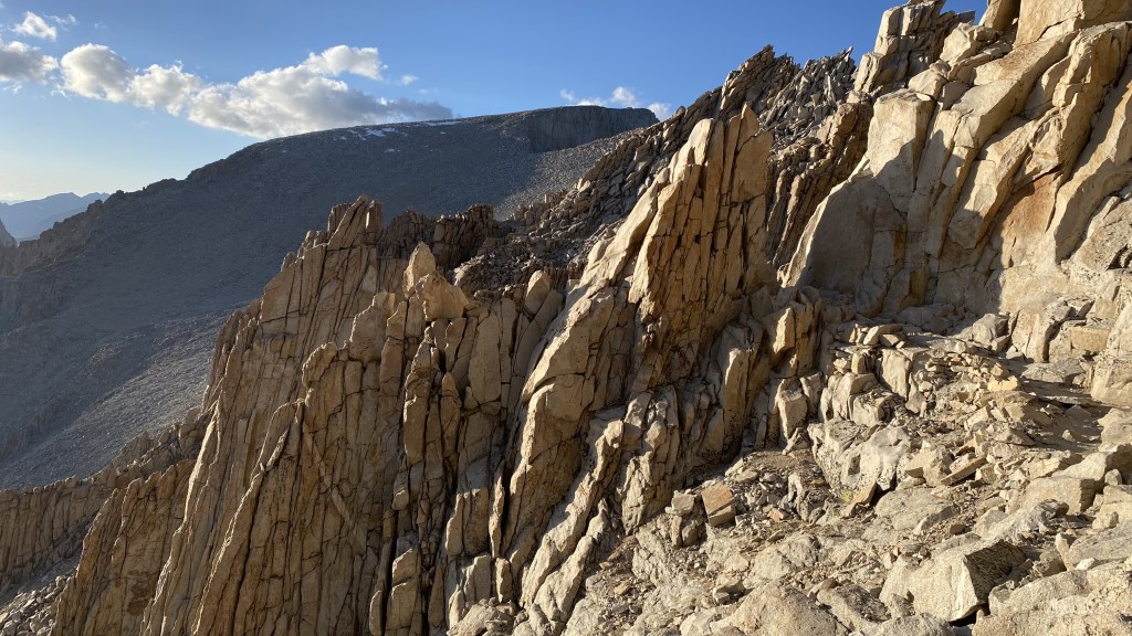
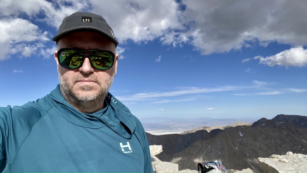
For as steep, exposed and jagged the entire ridge is, the backside is rather tame. All the steep needles or aigiulles in French are all scrambleable from the backside.


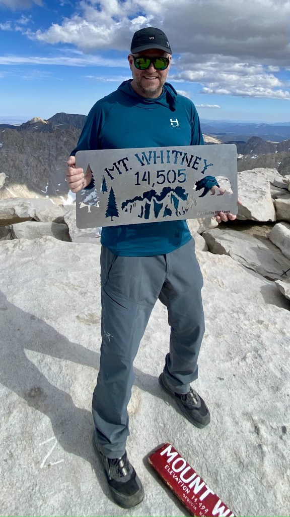


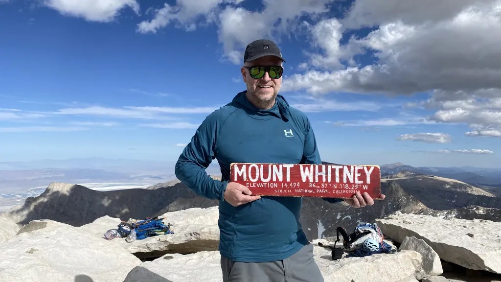
How many summit photos does one need? Apparently many.

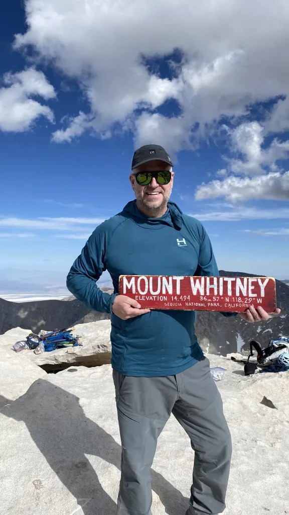


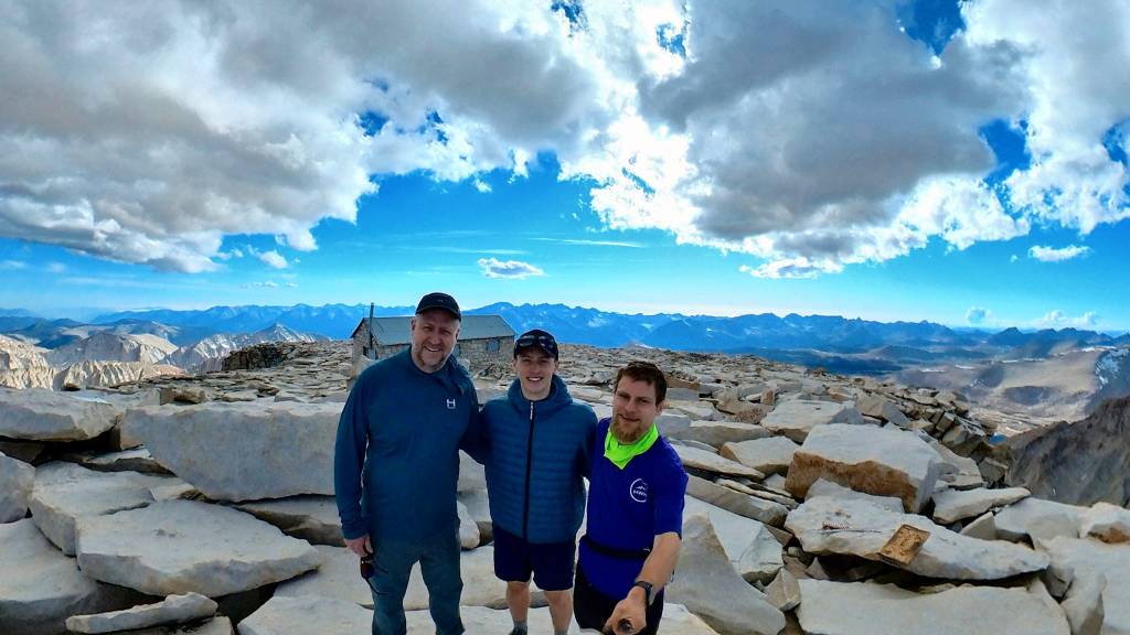
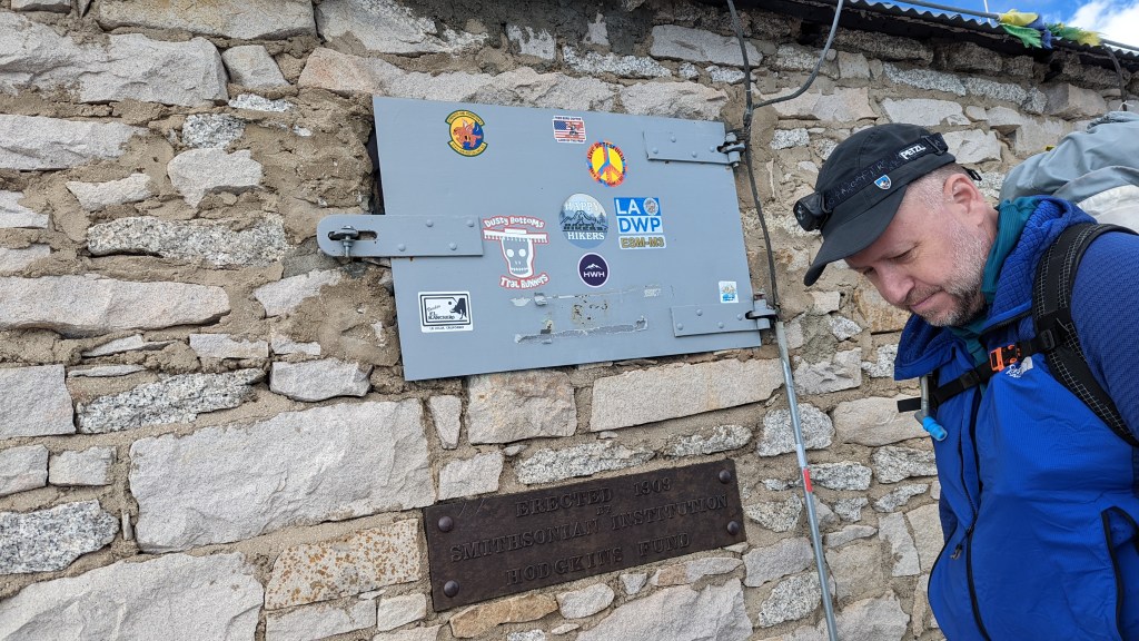
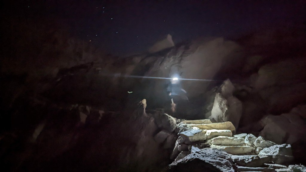
We lingered on the summit for probably 45 minutes. We came across another climber Tomahawk Tom and chatted for a bit. He was pretty cool and came up the backside from Crabtree Meadow – he must have been hiking the John Muir Trail. We finally got set for the descent – knowing our slow pace up only meant an Alpine Finish – my goal was to get down the 99 switchbacks prior to dark. Sadly we fell short.


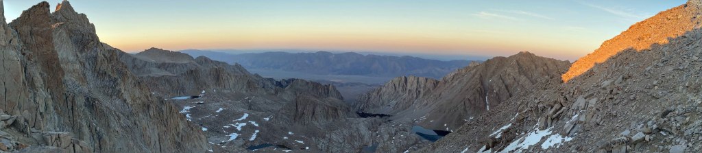
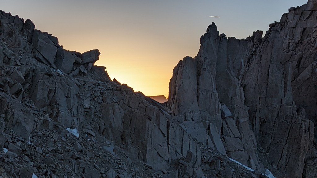
I love both sunsets and sunrises. It’s not often you get to see both on the same trip – you know its a long and hard day when you do!


We made our way down the 99 switchbacks in the setting sun. About half way down it got dark and we donned our headlamps. We took our time down as it was dark, we were tired, Will and Saul got sick on the summit and a fall would be very, very bad.
The way down the switchbacks was uneventful – no one fell or died. We filtered water at the spring. The way down was long, hard, and in the dark. I was knackered as my Brittish guide Richard from Chamonix would say. Thankfully Saul led thew way down. I started to hallucinate, seeing people and blow up XMas snowmen figures in the bushes. Terribly Disquieting. I thought I was on shrooms or LSD, neither of which I have partaken, and saw the most crazy shit coming down. Saul said this was not uncommon of Ultra Pedestrian athletes. Guess I made the club!

Details on the trip:
https://www.alltrails.com/explore/recording/mount-whitney-summit-01161aa
Amazing photos and experience! Those cloud formations were insane. And I would have LOVED to see a sunset like that! Had to laugh at the blowup snowmen in the bushes 😂😂😂😂badass, guys! Congrats on the summit! 🎉
Best Post Award goes to you. Thank you for sharing. We are doing it on July 25th. I hung on every word. Sounds EPIC!!I can’t wait 😊
Really awesome stuff Mark and I know it had to be very exciting making the journey back down as much as the one up! Bravo Zulu